You are here: Home > Network List > US - United States National Seismic Network Stations List
> Station AMTX Amarillo, Texas, USA > Earthquake Result Viewer
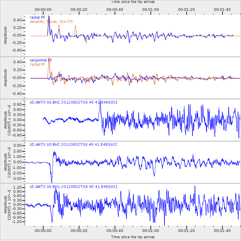
AMTX Amarillo, Texas, USA - Earthquake Result Viewer
*The percent match for this event was below the threshold and hence no stack was calculated.
| Earthquake location: |
Peru-Brazil Border Region |
| Earthquake latitude/longitude: |
-8.4/-74.3 |
| Earthquake time(UTC): |
2012/08/02 (215) 09:38:30 GMT |
| Earthquake Depth: |
145 km |
| Earthquake Magnitude: |
5.9 MB, 6.1 MW, 6.1 MW |
| Earthquake Catalog/Contributor: |
WHDF/NEIC |
|
| Network: |
US United States National Seismic Network |
| Station: |
AMTX Amarillo, Texas, USA |
| Lat/Lon: |
34.53 N/101.41 W |
| Elevation: |
1010 m |
|
| Distance: |
49.8 deg |
| Az: |
330.47 deg |
| Baz: |
143.796 deg |
| Ray Param: |
$rayparam |
*The percent match for this event was below the threshold and hence was not used in the summary stack. |
|
| Radial Match: |
86.21953 % |
| Radial Bump: |
400 |
| Transverse Match: |
72.36258 % |
| Transverse Bump: |
400 |
| SOD ConfigId: |
558545 |
| Insert Time: |
2013-09-17 16:10:01.782 +0000 |
| GWidth: |
2.5 |
| Max Bumps: |
400 |
| Tol: |
0.001 |
|
Signal To Noise
| Channel | StoN | STA | LTA |
| US:AMTX:00:BHZ:20120802T09:46:41.848993Z | 15.2117815 | 9.736058E-7 | 6.40034E-8 |
| US:AMTX:00:BH1:20120802T09:46:41.848993Z | 3.9686918 | 2.2772056E-7 | 5.7379253E-8 |
| US:AMTX:00:BH2:20120802T09:46:41.848993Z | 2.1951113 | 1.9788249E-7 | 9.0146905E-8 |
| Arrivals |
| Ps | |
| PpPs | |
| PsPs/PpSs | |


