You are here: Home > Network List > US - United States National Seismic Network Stations List
> Station MNTX Cornudas Mountains, Texas, USA > Earthquake Result Viewer
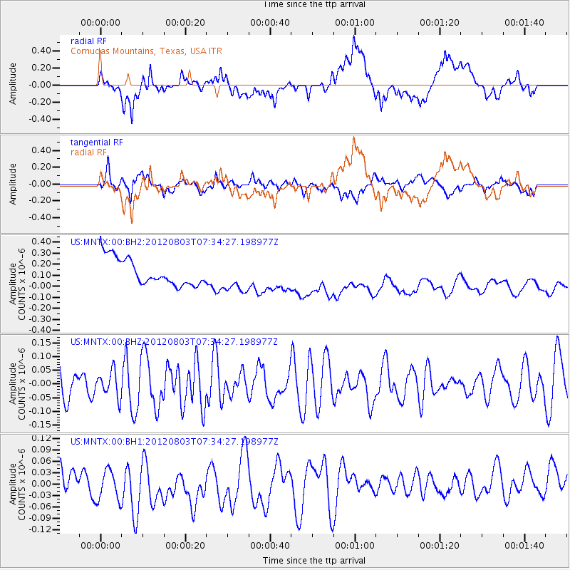
MNTX Cornudas Mountains, Texas, USA - Earthquake Result Viewer
*The percent match for this event was below the threshold and hence no stack was calculated.
| Earthquake location: |
Fiji Islands Region |
| Earthquake latitude/longitude: |
-16.9/-176.9 |
| Earthquake time(UTC): |
2012/08/03 (216) 07:22:30 GMT |
| Earthquake Depth: |
20 km |
| Earthquake Magnitude: |
5.5 MW, 5.1 MS, 5.0 MB, 5.5 MW |
| Earthquake Catalog/Contributor: |
WHDF/NEIC |
|
| Network: |
US United States National Seismic Network |
| Station: |
MNTX Cornudas Mountains, Texas, USA |
| Lat/Lon: |
31.70 N/105.38 W |
| Elevation: |
404 m |
|
| Distance: |
83.8 deg |
| Az: |
54.409 deg |
| Baz: |
245.956 deg |
| Ray Param: |
$rayparam |
*The percent match for this event was below the threshold and hence was not used in the summary stack. |
|
| Radial Match: |
30.905863 % |
| Radial Bump: |
400 |
| Transverse Match: |
45.598785 % |
| Transverse Bump: |
400 |
| SOD ConfigId: |
558545 |
| Insert Time: |
2013-09-17 16:17:36.657 +0000 |
| GWidth: |
2.5 |
| Max Bumps: |
400 |
| Tol: |
0.001 |
|
Signal To Noise
| Channel | StoN | STA | LTA |
| US:MNTX:00:BHZ:20120803T07:34:27.198977Z | 0.96546304 | 4.838374E-8 | 5.0114544E-8 |
| US:MNTX:00:BH1:20120803T07:34:27.198977Z | 1.1948227 | 6.1767246E-8 | 5.1695743E-8 |
| US:MNTX:00:BH2:20120803T07:34:27.198977Z | 1.1825383 | 1.4194606E-7 | 1.2003507E-7 |
| Arrivals |
| Ps | |
| PpPs | |
| PsPs/PpSs | |


