You are here: Home > Network List > US - United States National Seismic Network Stations List
> Station HAWA Hanford, Washington, USA > Earthquake Result Viewer
HAWA Hanford, Washington, USA - Earthquake Result Viewer
*The percent match for this event was below the threshold and hence no stack was calculated.
| Earthquake location: |
Fiji Islands Region |
| Earthquake latitude/longitude: |
-21.1/-178.4 |
| Earthquake time(UTC): |
2012/08/05 (218) 13:55:10 GMT |
| Earthquake Depth: |
484 km |
| Earthquake Magnitude: |
5.5 MB, 5.8 MW, 5.9 MW |
| Earthquake Catalog/Contributor: |
WHDF/NEIC |
|
| Network: |
US United States National Seismic Network |
| Station: |
HAWA Hanford, Washington, USA |
| Lat/Lon: |
46.39 N/119.53 W |
| Elevation: |
364 m |
|
| Distance: |
85.7 deg |
| Az: |
36.433 deg |
| Baz: |
233.22 deg |
| Ray Param: |
$rayparam |
*The percent match for this event was below the threshold and hence was not used in the summary stack. |
|
| Radial Match: |
72.87738 % |
| Radial Bump: |
400 |
| Transverse Match: |
63.37 % |
| Transverse Bump: |
385 |
| SOD ConfigId: |
558545 |
| Insert Time: |
2013-09-17 16:20:30.583 +0000 |
| GWidth: |
2.5 |
| Max Bumps: |
400 |
| Tol: |
0.001 |
|
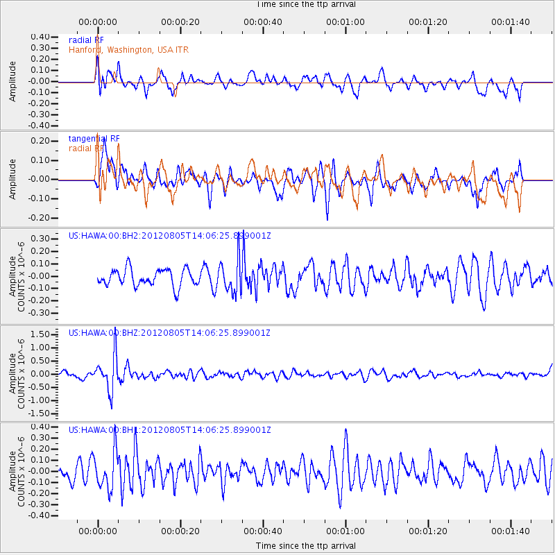
Signal To Noise
| Channel | StoN | STA | LTA |
| US:HAWA:00:BHZ:20120805T14:06:25.899001Z | 5.4293213 | 6.8121597E-7 | 1.2546982E-7 |
| US:HAWA:00:BH1:20120805T14:06:25.899001Z | 2.0833395 | 1.7230461E-7 | 8.2705974E-8 |
| US:HAWA:00:BH2:20120805T14:06:25.899001Z | 1.9369462 | 1.3271823E-7 | 6.851932E-8 |
| Arrivals |
| Ps | |
| PpPs | |
| PsPs/PpSs | |


