You are here: Home > Network List > US - United States National Seismic Network Stations List
> Station DGMT Dagmar, Montana, USA > Earthquake Result Viewer
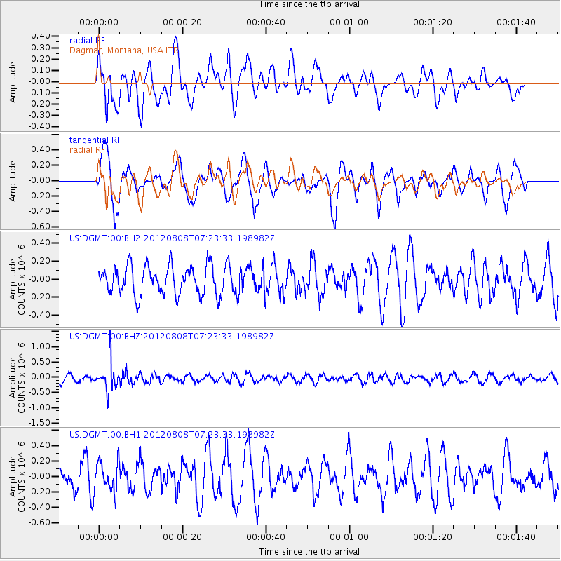
DGMT Dagmar, Montana, USA - Earthquake Result Viewer
*The percent match for this event was below the threshold and hence no stack was calculated.
| Earthquake location: |
Northeast Of Taiwan |
| Earthquake latitude/longitude: |
25.9/124.9 |
| Earthquake time(UTC): |
2012/08/08 (221) 07:11:01 GMT |
| Earthquake Depth: |
133 km |
| Earthquake Magnitude: |
5.5 MB, 5.4 MW, 5.4 MW |
| Earthquake Catalog/Contributor: |
WHDF/NEIC |
|
| Network: |
US United States National Seismic Network |
| Station: |
DGMT Dagmar, Montana, USA |
| Lat/Lon: |
48.47 N/104.20 W |
| Elevation: |
0.0 m |
|
| Distance: |
93.9 deg |
| Az: |
30.287 deg |
| Baz: |
316.943 deg |
| Ray Param: |
$rayparam |
*The percent match for this event was below the threshold and hence was not used in the summary stack. |
|
| Radial Match: |
56.206486 % |
| Radial Bump: |
400 |
| Transverse Match: |
61.60367 % |
| Transverse Bump: |
400 |
| SOD ConfigId: |
558545 |
| Insert Time: |
2013-09-17 16:28:07.881 +0000 |
| GWidth: |
2.5 |
| Max Bumps: |
400 |
| Tol: |
0.001 |
|
Signal To Noise
| Channel | StoN | STA | LTA |
| US:DGMT:00:BHZ:20120808T07:23:33.198982Z | 5.175784 | 4.4397243E-7 | 8.577877E-8 |
| US:DGMT:00:BH1:20120808T07:23:33.198982Z | 1.238726 | 1.8638328E-7 | 1.5046368E-7 |
| US:DGMT:00:BH2:20120808T07:23:33.198982Z | 1.0849695 | 1.6344615E-7 | 1.5064583E-7 |
| Arrivals |
| Ps | |
| PpPs | |
| PsPs/PpSs | |


