You are here: Home > Network List > US - United States National Seismic Network Stations List
> Station BOZ Bozeman, Montana, USA > Earthquake Result Viewer
BOZ Bozeman, Montana, USA - Earthquake Result Viewer
*The percent match for this event was below the threshold and hence no stack was calculated.
| Earthquake location: |
Alaska Peninsula |
| Earthquake latitude/longitude: |
54.9/-161.2 |
| Earthquake time(UTC): |
2012/08/08 (221) 14:05:17 GMT |
| Earthquake Depth: |
43 km |
| Earthquake Magnitude: |
5.6 MB, 5.2 MW, 5.1 MW |
| Earthquake Catalog/Contributor: |
WHDF/NEIC |
|
| Network: |
US United States National Seismic Network |
| Station: |
BOZ Bozeman, Montana, USA |
| Lat/Lon: |
45.65 N/111.63 W |
| Elevation: |
1589 m |
|
| Distance: |
32.4 deg |
| Az: |
85.645 deg |
| Baz: |
304.774 deg |
| Ray Param: |
$rayparam |
*The percent match for this event was below the threshold and hence was not used in the summary stack. |
|
| Radial Match: |
64.25565 % |
| Radial Bump: |
400 |
| Transverse Match: |
61.366505 % |
| Transverse Bump: |
400 |
| SOD ConfigId: |
558545 |
| Insert Time: |
2013-09-17 16:35:02.491 +0000 |
| GWidth: |
2.5 |
| Max Bumps: |
400 |
| Tol: |
0.001 |
|
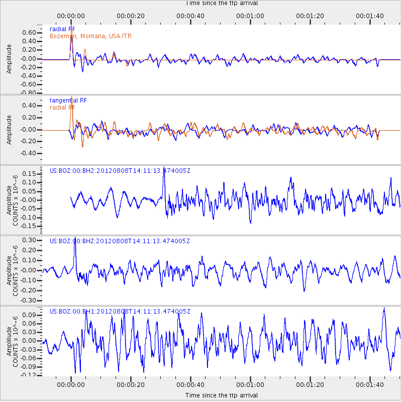
Signal To Noise
| Channel | StoN | STA | LTA |
| US:BOZ:00:BHZ:20120808T14:11:13.474005Z | 2.7091765 | 1.0860253E-7 | 4.0086917E-8 |
| US:BOZ:00:BH1:20120808T14:11:13.474005Z | 1.8853673 | 4.444531E-8 | 2.357382E-8 |
| US:BOZ:00:BH2:20120808T14:11:13.474005Z | 1.9263781 | 6.414269E-8 | 3.329704E-8 |
| Arrivals |
| Ps | |
| PpPs | |
| PsPs/PpSs | |


