You are here: Home > Network List > US - United States National Seismic Network Stations List
> Station MNTX Cornudas Mountains, Texas, USA > Earthquake Result Viewer
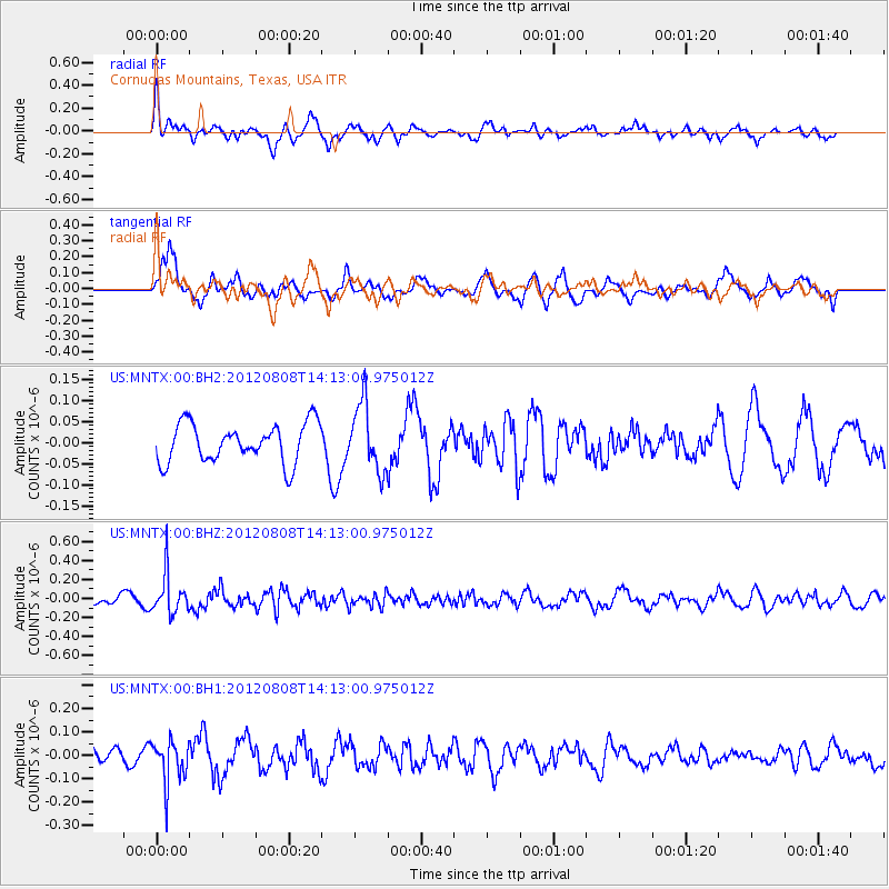
MNTX Cornudas Mountains, Texas, USA - Earthquake Result Viewer
*The percent match for this event was below the threshold and hence no stack was calculated.
| Earthquake location: |
Alaska Peninsula |
| Earthquake latitude/longitude: |
54.9/-161.2 |
| Earthquake time(UTC): |
2012/08/08 (221) 14:05:17 GMT |
| Earthquake Depth: |
43 km |
| Earthquake Magnitude: |
5.6 MB, 5.2 MW, 5.1 MW |
| Earthquake Catalog/Contributor: |
WHDF/NEIC |
|
| Network: |
US United States National Seismic Network |
| Station: |
MNTX Cornudas Mountains, Texas, USA |
| Lat/Lon: |
31.70 N/105.38 W |
| Elevation: |
404 m |
|
| Distance: |
45.3 deg |
| Az: |
97.156 deg |
| Baz: |
317.728 deg |
| Ray Param: |
$rayparam |
*The percent match for this event was below the threshold and hence was not used in the summary stack. |
|
| Radial Match: |
59.218845 % |
| Radial Bump: |
395 |
| Transverse Match: |
58.33501 % |
| Transverse Bump: |
400 |
| SOD ConfigId: |
558545 |
| Insert Time: |
2013-09-17 16:36:43.919 +0000 |
| GWidth: |
2.5 |
| Max Bumps: |
400 |
| Tol: |
0.001 |
|
Signal To Noise
| Channel | StoN | STA | LTA |
| US:MNTX:00:BHZ:20120808T14:13:00.975012Z | 6.4415255 | 2.1128899E-7 | 3.280108E-8 |
| US:MNTX:00:BH1:20120808T14:13:00.975012Z | 2.603691 | 9.31795E-8 | 3.5787462E-8 |
| US:MNTX:00:BH2:20120808T14:13:00.975012Z | 1.7276033 | 7.963876E-8 | 4.6097828E-8 |
| Arrivals |
| Ps | |
| PpPs | |
| PsPs/PpSs | |


