KAPI Kappang, Sulawesi, Indonesia - Earthquake Result Viewer
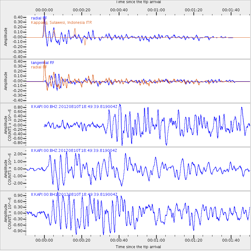
Earthquake location: Fox Islands, Aleutian Islands
Earthquake latitude/longitude: 52.6/-167.4
Earthquake time(UTC): 2012/08/10 (223) 18:37:43 GMT
Earthquake Depth: 13 km
Earthquake Magnitude: 5.9 MB, 6.2 MS, 6.2 MW, 6.2 MW
Earthquake Catalog/Contributor: WHDF/NEIC
Network: II Global Seismograph Network (GSN - IRIS/IDA)
Station: KAPI Kappang, Sulawesi, Indonesia
Lat/Lon: 5.01 S/119.75 E
Elevation: 300 m
Distance: 83.7 deg
Az: 253.27 deg
Baz: 35.867 deg
Ray Param: 0.046025395
Estimated Moho Depth: 21.75 km
Estimated Crust Vp/Vs: 1.78
Assumed Crust Vp: 6.343 km/s
Estimated Crust Vs: 3.564 km/s
Estimated Crust Poisson's Ratio: 0.27
Radial Match: 96.00048 %
Radial Bump: 388
Transverse Match: 85.66986 %
Transverse Bump: 400
SOD ConfigId: 558545
Insert Time: 2013-09-17 16:41:38.826 +0000
GWidth: 2.5
Max Bumps: 400
Tol: 0.001

Signal To Noise

ChannelStoNSTALTA
II:KAPI:00:BHZ:20120810T18:49:39.819004Z8.5523449.632273E-71.1262728E-7
II:KAPI:00:BH1:20120810T18:49:39.819004Z4.5390233.183471E-77.01356E-8
II:KAPI:00:BH2:20120810T18:49:39.819004Z2.62782842.390202E-79.095731E-8
Arrivals
Ps2.7 SECOND
PpPs9.3 SECOND
PsPs/PpSs12 SECOND