ANMO Albuquerque, New Mexico, USA - Earthquake Result Viewer
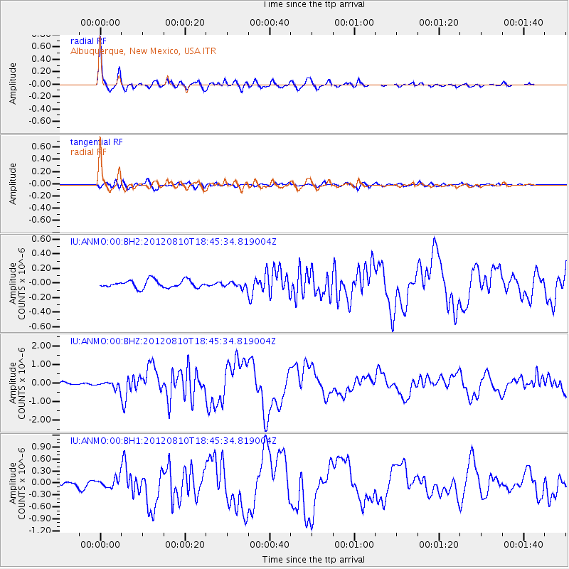
Earthquake location: Fox Islands, Aleutian Islands
Earthquake latitude/longitude: 52.6/-167.4
Earthquake time(UTC): 2012/08/10 (223) 18:37:43 GMT
Earthquake Depth: 13 km
Earthquake Magnitude: 5.9 MB, 6.2 MS, 6.2 MW, 6.2 MW
Earthquake Catalog/Contributor: WHDF/NEIC
Network: IU Global Seismograph Network (GSN - IRIS/USGS)
Station: ANMO Albuquerque, New Mexico, USA
Lat/Lon: 34.95 N/106.46 W
Elevation: 1820 m
Distance: 46.0 deg
Az: 87.494 deg
Baz: 312.164 deg
Ray Param: 0.070929
Estimated Moho Depth: 41.75 km
Estimated Crust Vp/Vs: 1.66
Assumed Crust Vp: 6.502 km/s
Estimated Crust Vs: 3.911 km/s
Estimated Crust Poisson's Ratio: 0.22
Radial Match: 96.51763 %
Radial Bump: 386
Transverse Match: 83.500496 %
Transverse Bump: 400
SOD ConfigId: 558545
Insert Time: 2013-09-17 16:42:00.144 +0000
GWidth: 2.5
Max Bumps: 400
Tol: 0.001

Signal To Noise

ChannelStoNSTALTA
IU:ANMO:00:BHZ:20120810T18:45:34.819004Z2.8875881.8306773E-76.339815E-8
IU:ANMO:00:BH1:20120810T18:45:34.819004Z2.81393221.2582716E-74.4715772E-8
IU:ANMO:00:BH2:20120810T18:45:34.819004Z0.74974083.882526E-85.1784912E-8
Arrivals
Ps4.6 SECOND
PpPs16 SECOND
PsPs/PpSs21 SECOND