CCM Cathedral Cave, Missouri, USA - Earthquake Result Viewer
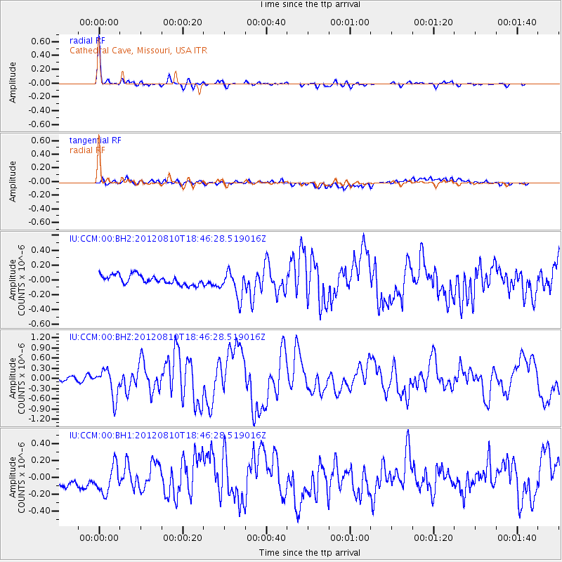
Earthquake location: Fox Islands, Aleutian Islands
Earthquake latitude/longitude: 52.6/-167.4
Earthquake time(UTC): 2012/08/10 (223) 18:37:43 GMT
Earthquake Depth: 13 km
Earthquake Magnitude: 5.9 MB, 6.2 MS, 6.2 MW, 6.2 MW
Earthquake Catalog/Contributor: WHDF/NEIC
Network: IU Global Seismograph Network (GSN - IRIS/USGS)
Station: CCM Cathedral Cave, Missouri, USA
Lat/Lon: 38.06 N/91.24 W
Elevation: 222 m
Distance: 53.0 deg
Az: 73.669 deg
Baz: 312.189 deg
Ray Param: 0.06637692
Estimated Moho Depth: 40.75 km
Estimated Crust Vp/Vs: 1.85
Assumed Crust Vp: 6.498 km/s
Estimated Crust Vs: 3.507 km/s
Estimated Crust Poisson's Ratio: 0.29
Radial Match: 94.03525 %
Radial Bump: 279
Transverse Match: 54.220757 %
Transverse Bump: 400
SOD ConfigId: 558545
Insert Time: 2013-09-17 16:42:06.943 +0000
GWidth: 2.5
Max Bumps: 400
Tol: 0.001

Signal To Noise

ChannelStoNSTALTA
IU:CCM:00:BHZ:20120810T18:46:28.519016Z7.07544954.3161626E-76.1001955E-8
IU:CCM:00:BH1:20120810T18:46:28.519016Z2.17057321.7900012E-78.2466755E-8
IU:CCM:00:BH2:20120810T18:46:28.519016Z2.9280441.8190845E-76.212627E-8
Arrivals
Ps5.6 SECOND
PpPs17 SECOND
PsPs/PpSs23 SECOND