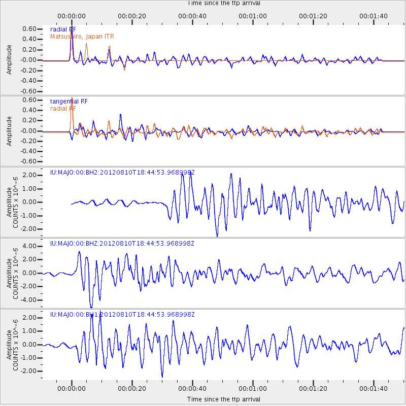
MAJO Matsushiro, Japan - Earthquake Result Viewer
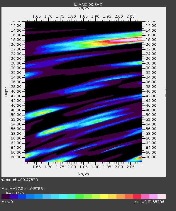
Earthquake location: Fox Islands, Aleutian Islands
Earthquake latitude/longitude: 52.6/-167.4
Earthquake time(UTC): 2012/08/10 (223) 18:37:43 GMT
Earthquake Depth: 13 km
Earthquake Magnitude: 5.9 MB, 6.2 MS, 6.2 MW, 6.2 MW
Earthquake Catalog/Contributor: WHDF/NEIC
Network: IU Global Seismograph Network (GSN - IRIS/USGS)
Station: MAJO Matsushiro, Japan
Lat/Lon: 36.55 N/138.20 E
Elevation: 405 m
Distance: 40.9 deg
Az: 269.08 deg
Baz: 49.18 deg
Ray Param: 0.07412233
Estimated Moho Depth: 17.5 km
Estimated Crust Vp/Vs: 2.08
Assumed Crust Vp: 6.461 km/s
Estimated Crust Vs: 3.11 km/s
Estimated Crust Poisson's Ratio: 0.35
Radial Match: 90.47573 %
Radial Bump: 383
Transverse Match: 79.70584 %
Transverse Bump: 400
SOD ConfigId: 558545
Insert Time: 2013-09-17 16:43:01.761 +0000
GWidth: 2.5
Max Bumps: 400
Tol: 0.001

Signal To Noise

ChannelStoNSTALTA
IU:MAJO:00:BHZ:20120810T18:44:53.968998Z12.2533081.5891447E-61.2969107E-7
IU:MAJO:00:BH1:20120810T18:44:53.968998Z4.1020345.9014565E-71.4386659E-7
IU:MAJO:00:BH2:20120810T18:44:53.968998Z4.60366345.726781E-71.2439617E-7
Arrivals
Ps3.1 SECOND
PpPs7.9 SECOND
PsPs/PpSs11 SECOND