You are here: Home > Network List > US - United States National Seismic Network Stations List
> Station AMTX Amarillo, Texas, USA > Earthquake Result Viewer
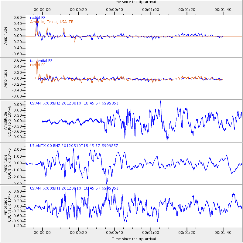
AMTX Amarillo, Texas, USA - Earthquake Result Viewer
*The percent match for this event was below the threshold and hence no stack was calculated.
| Earthquake location: |
Fox Islands, Aleutian Islands |
| Earthquake latitude/longitude: |
52.6/-167.4 |
| Earthquake time(UTC): |
2012/08/10 (223) 18:37:43 GMT |
| Earthquake Depth: |
13 km |
| Earthquake Magnitude: |
5.9 MB, 6.2 MS, 6.2 MW, 6.2 MW |
| Earthquake Catalog/Contributor: |
WHDF/NEIC |
|
| Network: |
US United States National Seismic Network |
| Station: |
AMTX Amarillo, Texas, USA |
| Lat/Lon: |
34.53 N/101.41 W |
| Elevation: |
1010 m |
|
| Distance: |
49.3 deg |
| Az: |
84.11 deg |
| Baz: |
312.748 deg |
| Ray Param: |
$rayparam |
*The percent match for this event was below the threshold and hence was not used in the summary stack. |
|
| Radial Match: |
93.68243 % |
| Radial Bump: |
400 |
| Transverse Match: |
66.447945 % |
| Transverse Bump: |
400 |
| SOD ConfigId: |
558545 |
| Insert Time: |
2013-09-17 16:44:21.722 +0000 |
| GWidth: |
2.5 |
| Max Bumps: |
400 |
| Tol: |
0.001 |
|
Signal To Noise
| Channel | StoN | STA | LTA |
| US:AMTX:00:BHZ:20120810T18:45:57.699985Z | 6.347811 | 7.034895E-7 | 1.1082395E-7 |
| US:AMTX:00:BH1:20120810T18:45:57.699985Z | 1.6242586 | 2.0589302E-7 | 1.2676122E-7 |
| US:AMTX:00:BH2:20120810T18:45:57.699985Z | 3.020312 | 2.6049378E-7 | 8.6247304E-8 |
| Arrivals |
| Ps | |
| PpPs | |
| PsPs/PpSs | |


