
BLA Blacksburg, Virginia, USA - Earthquake Result Viewer
| ||||||||||||||||||
| ||||||||||||||||||
| ||||||||||||||||||
|
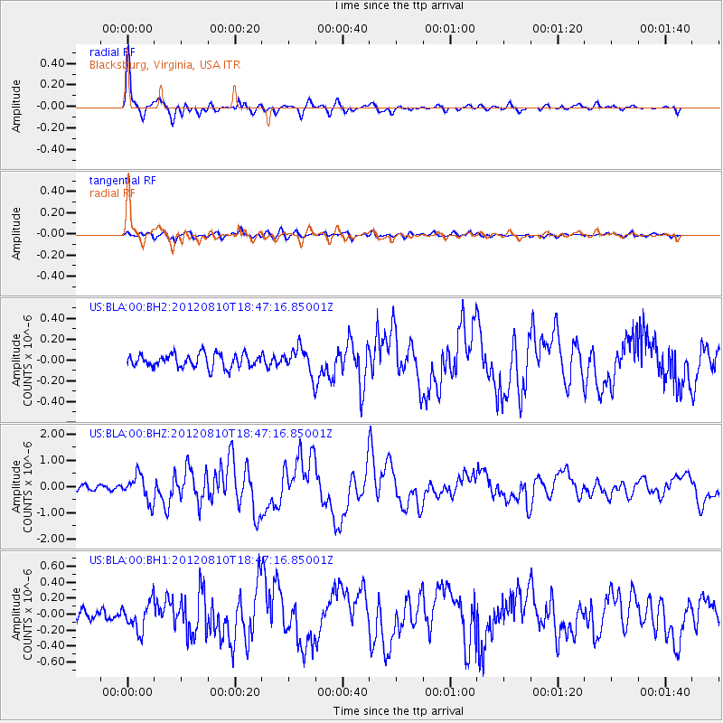
Signal To Noise
| Channel | StoN | STA | LTA |
| US:BLA:00:BHZ:20120810T18:47:16.85001Z | 6.6191983 | 5.050835E-7 | 7.6305845E-8 |
| US:BLA:00:BH1:20120810T18:47:16.85001Z | 3.0526514 | 1.7979532E-7 | 5.8898085E-8 |
| US:BLA:00:BH2:20120810T18:47:16.85001Z | 1.9602463 | 1.2601986E-7 | 6.428777E-8 |
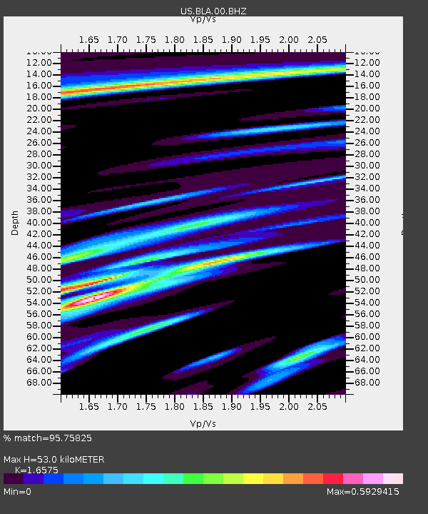
| Arrivals | |
| Ps | 5.9 SECOND |
| PpPs | 22 SECOND |
| PsPs/PpSs | 28 SECOND |

