
DGMT Dagmar, Montana, USA - Earthquake Result Viewer
| ||||||||||||||||||
| ||||||||||||||||||
| ||||||||||||||||||
|
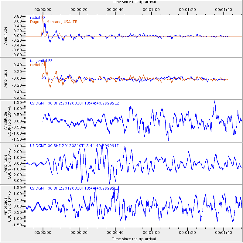
Signal To Noise
| Channel | StoN | STA | LTA |
| US:DGMT:00:BHZ:20120810T18:44:40.299991Z | 5.892984 | 5.6861563E-7 | 9.649028E-8 |
| US:DGMT:00:BH1:20120810T18:44:40.299991Z | 1.1024953 | 1.8783525E-7 | 1.7037284E-7 |
| US:DGMT:00:BH2:20120810T18:44:40.299991Z | 1.1215758 | 2.8759115E-7 | 2.5641705E-7 |
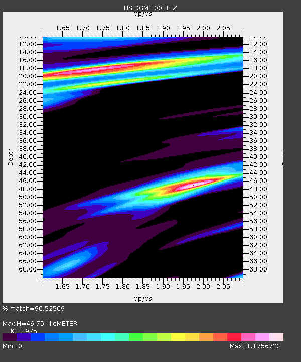
| Arrivals | |
| Ps | 7.5 SECOND |
| PpPs | 20 SECOND |
| PsPs/PpSs | 28 SECOND |

