
EGMT Eagleton, Montana, USA - Earthquake Result Viewer
| ||||||||||||||||||
| ||||||||||||||||||
| ||||||||||||||||||
|
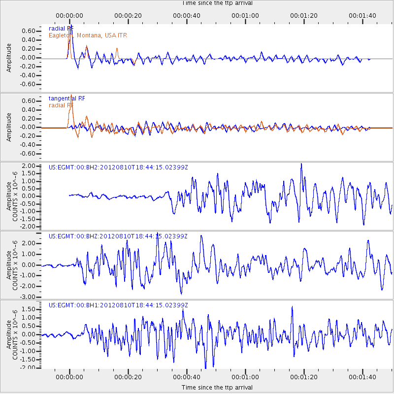
Signal To Noise
| Channel | StoN | STA | LTA |
| US:EGMT:00:BHZ:20120810T18:44:15.02399Z | 5.9099975 | 3.8544502E-7 | 6.521915E-8 |
| US:EGMT:00:BH1:20120810T18:44:15.02399Z | 1.318899 | 1.2123535E-7 | 9.192162E-8 |
| US:EGMT:00:BH2:20120810T18:44:15.02399Z | 1.9486046 | 1.7006496E-7 | 8.727526E-8 |
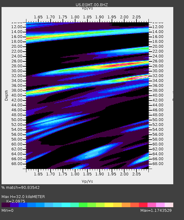
| Arrivals | |
| Ps | 5.8 SECOND |
| PpPs | 14 SECOND |
| PsPs/PpSs | 20 SECOND |

