
GOGA Godfrey, Georgia, USA - Earthquake Result Viewer
| ||||||||||||||||||
| ||||||||||||||||||
| ||||||||||||||||||
|
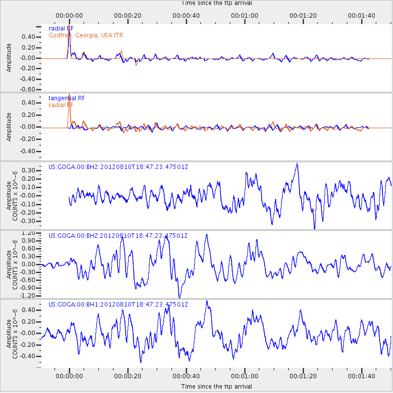
Signal To Noise
| Channel | StoN | STA | LTA |
| US:GOGA:00:BHZ:20120810T18:47:23.47501Z | 3.269254 | 2.5243537E-7 | 7.721498E-8 |
| US:GOGA:00:BH1:20120810T18:47:23.47501Z | 3.4545257 | 1.4898006E-7 | 4.3126054E-8 |
| US:GOGA:00:BH2:20120810T18:47:23.47501Z | 1.7969104 | 8.323451E-8 | 4.6320903E-8 |
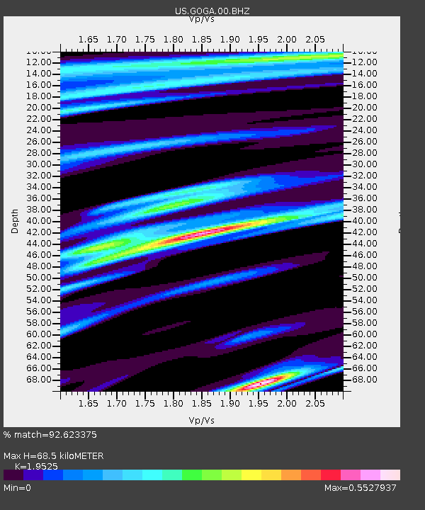
| Arrivals | |
| Ps | 10 SECOND |
| PpPs | 29 SECOND |
| PsPs/PpSs | 40 SECOND |

