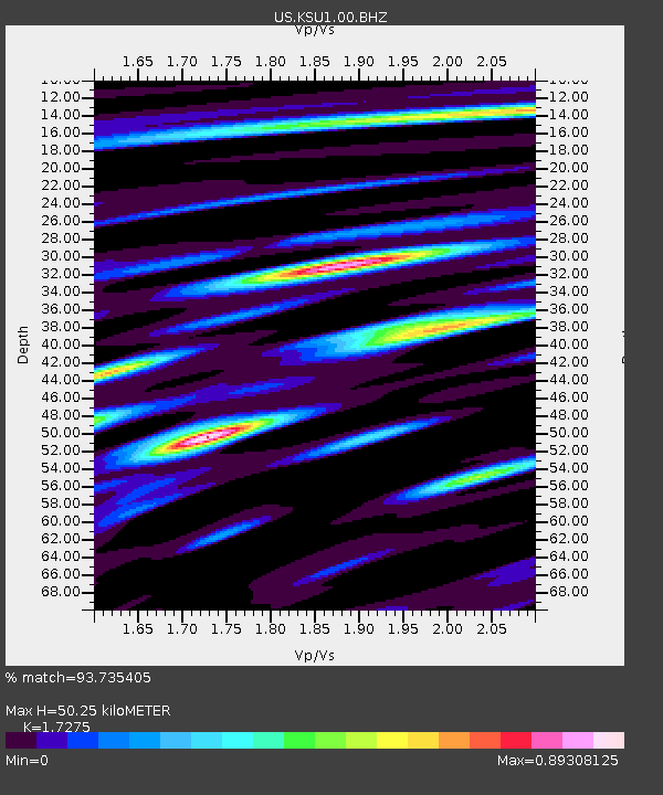
KSU1 Kansas State University--Konza Prairie, Kansas, USA - Earthquake Result Viewer
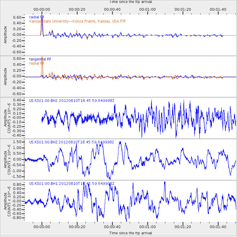
Earthquake location: Fox Islands, Aleutian Islands
Earthquake latitude/longitude: 52.6/-167.4
Earthquake time(UTC): 2012/08/10 (223) 18:37:43 GMT
Earthquake Depth: 13 km
Earthquake Magnitude: 5.9 MB, 6.2 MS, 6.2 MW, 6.2 MW
Earthquake Catalog/Contributor: WHDF/NEIC
Network: US United States National Seismic Network
Station: KSU1 Kansas State University--Konza Prairie, Kansas, USA
Lat/Lon: 39.10 N/96.61 W
Elevation: 347 m
Distance: 49.2 deg
Az: 76.23 deg
Baz: 310.466 deg
Ray Param: 0.06886663
Estimated Moho Depth: 50.25 km
Estimated Crust Vp/Vs: 1.73
Assumed Crust Vp: 6.483 km/s
Estimated Crust Vs: 3.753 km/s
Estimated Crust Poisson's Ratio: 0.25
Radial Match: 93.735405 %
Radial Bump: 400
Transverse Match: 67.657265 %
Transverse Bump: 400
SOD ConfigId: 558545
Insert Time: 2013-09-17 16:45:39.867 +0000
GWidth: 2.5
Max Bumps: 400
Tol: 0.001

Signal To Noise

ChannelStoNSTALTA
US:KSU1:00:BHZ:20120810T18:45:59.649998Z5.63400173.9354072E-76.985101E-8
US:KSU1:00:BH1:20120810T18:45:59.649998Z3.74147442.4932675E-76.6638634E-8
US:KSU1:00:BH2:20120810T18:45:59.649998Z0.767191956.9549884E-89.0655135E-8
Arrivals
Ps6.0 SECOND
PpPs20 SECOND
PsPs/PpSs26 SECOND