MIAR Mount Ida, Arkansas, USA - Earthquake Result Viewer
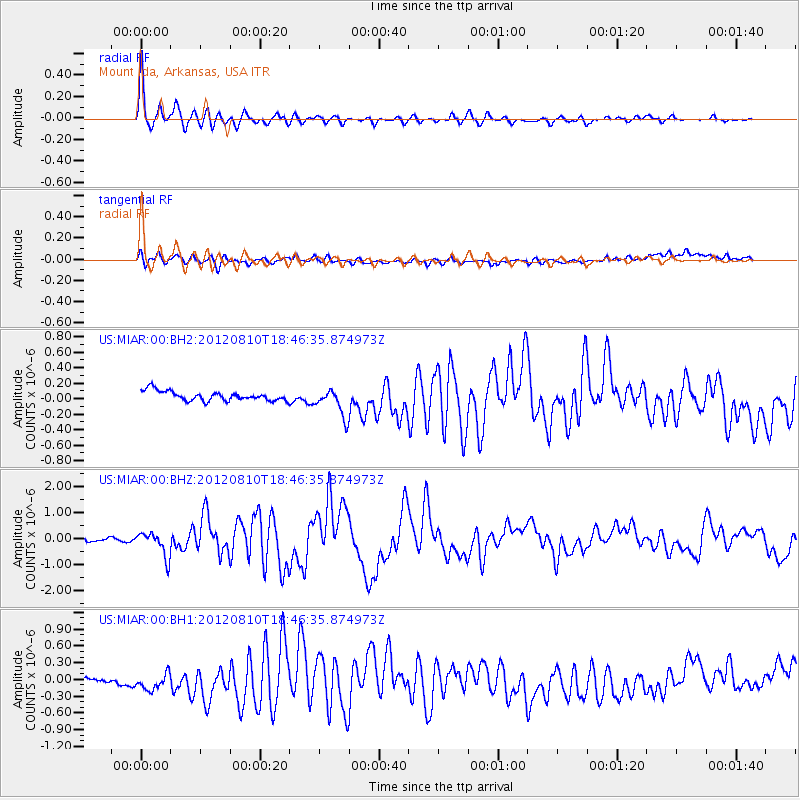
Earthquake location: Fox Islands, Aleutian Islands
Earthquake latitude/longitude: 52.6/-167.4
Earthquake time(UTC): 2012/08/10 (223) 18:37:43 GMT
Earthquake Depth: 13 km
Earthquake Magnitude: 5.9 MB, 6.2 MS, 6.2 MW, 6.2 MW
Earthquake Catalog/Contributor: WHDF/NEIC
Network: US United States National Seismic Network
Station: MIAR Mount Ida, Arkansas, USA
Lat/Lon: 34.55 N/93.58 W
Elevation: 207 m
Distance: 54.0 deg
Az: 78.455 deg
Baz: 313.661 deg
Ray Param: 0.06570204
Estimated Moho Depth: 20.5 km
Estimated Crust Vp/Vs: 1.97
Assumed Crust Vp: 6.498 km/s
Estimated Crust Vs: 3.307 km/s
Estimated Crust Poisson's Ratio: 0.33
Radial Match: 95.76731 %
Radial Bump: 400
Transverse Match: 43.10612 %
Transverse Bump: 400
SOD ConfigId: 558545
Insert Time: 2013-09-17 16:45:58.185 +0000
GWidth: 2.5
Max Bumps: 400
Tol: 0.001

Signal To Noise

ChannelStoNSTALTA
US:MIAR:00:BHZ:20120810T18:46:35.874973Z6.7006514.793263E-77.153428E-8
US:MIAR:00:BH1:20120810T18:46:35.874973Z3.50946741.785807E-75.088541E-8
US:MIAR:00:BH2:20120810T18:46:35.874973Z2.92571161.8039086E-76.165708E-8
Arrivals
Ps3.2 SECOND
PpPs8.9 SECOND
PsPs/PpSs12 SECOND