TPNV Topopah Spring, Nevada, USA - Earthquake Result Viewer
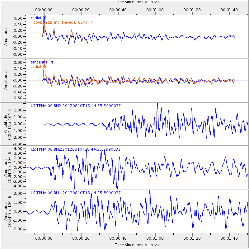
Earthquake location: Fox Islands, Aleutian Islands
Earthquake latitude/longitude: 52.6/-167.4
Earthquake time(UTC): 2012/08/10 (223) 18:37:43 GMT
Earthquake Depth: 13 km
Earthquake Magnitude: 5.9 MB, 6.2 MS, 6.2 MW, 6.2 MW
Earthquake Catalog/Contributor: WHDF/NEIC
Network: US United States National Seismic Network
Station: TPNV Topopah Spring, Nevada, USA
Lat/Lon: 36.95 N/116.25 W
Elevation: 1600 m
Distance: 38.7 deg
Az: 93.065 deg
Baz: 310.56 deg
Ray Param: 0.0754142
Estimated Moho Depth: 43.5 km
Estimated Crust Vp/Vs: 1.76
Assumed Crust Vp: 6.279 km/s
Estimated Crust Vs: 3.572 km/s
Estimated Crust Poisson's Ratio: 0.26
Radial Match: 89.95488 %
Radial Bump: 400
Transverse Match: 78.70467 %
Transverse Bump: 400
SOD ConfigId: 558545
Insert Time: 2013-09-17 16:46:36.583 +0000
GWidth: 2.5
Max Bumps: 400
Tol: 0.001

Signal To Noise

ChannelStoNSTALTA
US:TPNV:00:BHZ:20120810T18:44:35.599003Z4.9102255.769917E-71.1750819E-7
US:TPNV:00:BH1:20120810T18:44:35.599003Z2.04610873.220869E-71.5741435E-7
US:TPNV:00:BH2:20120810T18:44:35.599003Z2.88257433.155492E-71.09467834E-7
Arrivals
Ps5.6 SECOND
PpPs18 SECOND
PsPs/PpSs23 SECOND