WVOR Wild Horse Valley, Oregon, USA - Earthquake Result Viewer
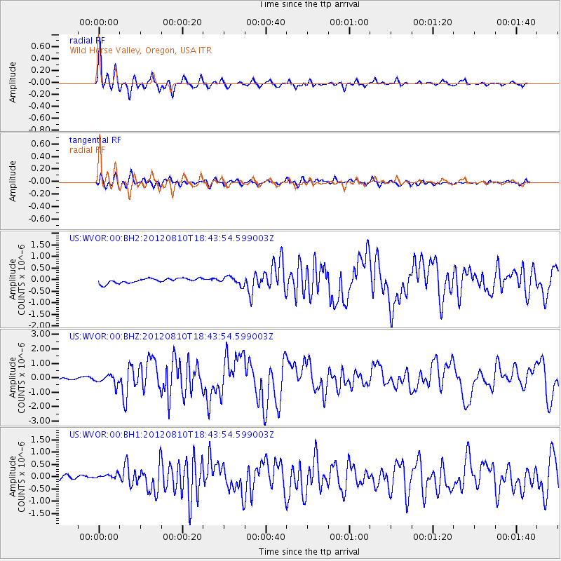
Earthquake location: Fox Islands, Aleutian Islands
Earthquake latitude/longitude: 52.6/-167.4
Earthquake time(UTC): 2012/08/10 (223) 18:37:43 GMT
Earthquake Depth: 13 km
Earthquake Magnitude: 5.9 MB, 6.2 MS, 6.2 MW, 6.2 MW
Earthquake Catalog/Contributor: WHDF/NEIC
Network: US United States National Seismic Network
Station: WVOR Wild Horse Valley, Oregon, USA
Lat/Lon: 42.43 N/118.64 W
Elevation: 1344 m
Distance: 33.9 deg
Az: 87.632 deg
Baz: 304.655 deg
Ray Param: 0.0780007
Estimated Moho Depth: 34.75 km
Estimated Crust Vp/Vs: 1.69
Assumed Crust Vp: 6.279 km/s
Estimated Crust Vs: 3.726 km/s
Estimated Crust Poisson's Ratio: 0.23
Radial Match: 94.19716 %
Radial Bump: 290
Transverse Match: 78.69189 %
Transverse Bump: 400
SOD ConfigId: 558545
Insert Time: 2013-09-17 16:46:51.562 +0000
GWidth: 2.5
Max Bumps: 400
Tol: 0.001

Signal To Noise

ChannelStoNSTALTA
US:WVOR:00:BHZ:20120810T18:43:54.599003Z7.42973.42338E-74.6076963E-8
US:WVOR:00:BH1:20120810T18:43:54.599003Z1.6033971.2504482E-77.798743E-8
US:WVOR:00:BH2:20120810T18:43:54.599003Z1.77263651.8132494E-71.022911E-7
Arrivals
Ps4.1 SECOND
PpPs14 SECOND
PsPs/PpSs18 SECOND