You are here: Home > Network List > US - United States National Seismic Network Stations List
> Station HDIL Hopedale, Illinois, USA > Earthquake Result Viewer
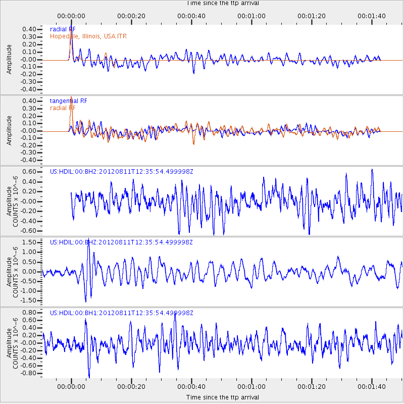
HDIL Hopedale, Illinois, USA - Earthquake Result Viewer
*The percent match for this event was below the threshold and hence no stack was calculated.
| Earthquake location: |
Armenia-Azerbaijan-Iran Bord Reg |
| Earthquake latitude/longitude: |
38.3/46.8 |
| Earthquake time(UTC): |
2012/08/11 (224) 12:23:18 GMT |
| Earthquake Depth: |
11 km |
| Earthquake Magnitude: |
6.4 MW, 6.2 MB, 6.4 MW, 6.7 MS |
| Earthquake Catalog/Contributor: |
NEIC PDE/NEIC PDE-W |
|
| Network: |
US United States National Seismic Network |
| Station: |
HDIL Hopedale, Illinois, USA |
| Lat/Lon: |
40.56 N/89.29 W |
| Elevation: |
219 m |
|
| Distance: |
91.8 deg |
| Az: |
328.103 deg |
| Baz: |
33.054 deg |
| Ray Param: |
$rayparam |
*The percent match for this event was below the threshold and hence was not used in the summary stack. |
|
| Radial Match: |
69.7738 % |
| Radial Bump: |
400 |
| Transverse Match: |
63.086334 % |
| Transverse Bump: |
400 |
| SOD ConfigId: |
558545 |
| Insert Time: |
2013-09-17 16:50:22.494 +0000 |
| GWidth: |
2.5 |
| Max Bumps: |
400 |
| Tol: |
0.001 |
|
Signal To Noise
| Channel | StoN | STA | LTA |
| US:HDIL:00:BHZ:20120811T12:35:54.499998Z | 3.2627711 | 4.4240525E-7 | 1.3559188E-7 |
| US:HDIL:00:BH1:20120811T12:35:54.499998Z | 1.3641187 | 1.8606421E-7 | 1.3639884E-7 |
| US:HDIL:00:BH2:20120811T12:35:54.499998Z | 0.8557137 | 1.3533179E-7 | 1.5815078E-7 |
| Arrivals |
| Ps | |
| PpPs | |
| PsPs/PpSs | |


