You are here: Home > Network List > IU - Global Seismograph Network (GSN - IRIS/USGS) Stations List
> Station RSSD Black Hills, South Dakota, USA > Earthquake Result Viewer
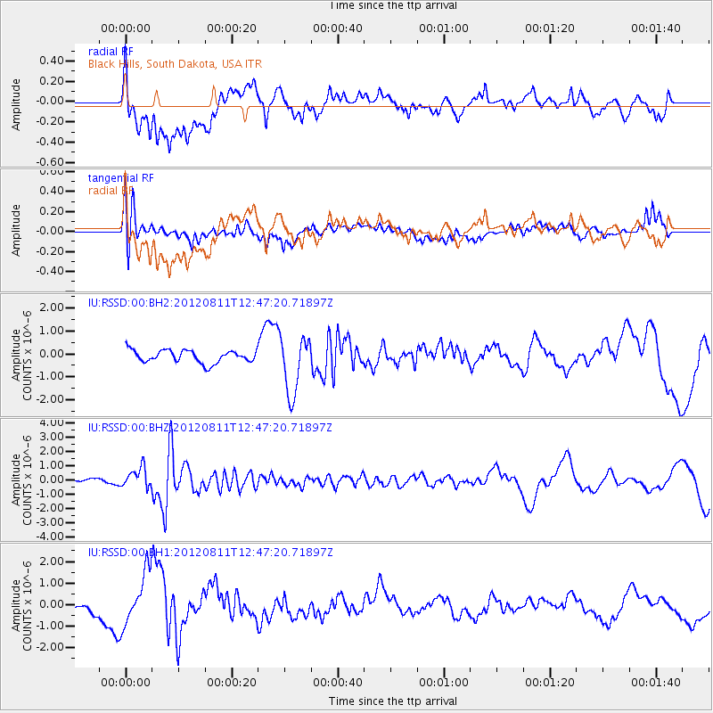
RSSD Black Hills, South Dakota, USA - Earthquake Result Viewer
*The percent match for this event was below the threshold and hence no stack was calculated.
| Earthquake location: |
Armenia-Azerbaijan-Iran Bord Reg |
| Earthquake latitude/longitude: |
38.4/46.7 |
| Earthquake time(UTC): |
2012/08/11 (224) 12:34:35 GMT |
| Earthquake Depth: |
12 km |
| Earthquake Magnitude: |
6.3 MW, 6.2 MW, 6.3 MB |
| Earthquake Catalog/Contributor: |
NEIC PDE/NEIC PDE-W |
|
| Network: |
IU Global Seismograph Network (GSN - IRIS/USGS) |
| Station: |
RSSD Black Hills, South Dakota, USA |
| Lat/Lon: |
44.12 N/104.04 W |
| Elevation: |
2090 m |
|
| Distance: |
93.7 deg |
| Az: |
339.371 deg |
| Baz: |
22.608 deg |
| Ray Param: |
$rayparam |
*The percent match for this event was below the threshold and hence was not used in the summary stack. |
|
| Radial Match: |
48.33516 % |
| Radial Bump: |
400 |
| Transverse Match: |
39.595226 % |
| Transverse Bump: |
400 |
| SOD ConfigId: |
558545 |
| Insert Time: |
2013-09-17 16:53:21.262 +0000 |
| GWidth: |
2.5 |
| Max Bumps: |
400 |
| Tol: |
0.001 |
|
Signal To Noise
| Channel | StoN | STA | LTA |
| IU:RSSD:00:BHZ:20120811T12:47:20.71897Z | 3.3962505 | 7.0542603E-7 | 2.0770732E-7 |
| IU:RSSD:00:BH1:20120811T12:47:20.71897Z | 7.088488 | 1.2290858E-6 | 1.7339181E-7 |
| IU:RSSD:00:BH2:20120811T12:47:20.71897Z | 4.6705112 | 1.2740928E-6 | 2.7279515E-7 |
| Arrivals |
| Ps | |
| PpPs | |
| PsPs/PpSs | |


