You are here: Home > Network List > KN - Kyrgyz Seismic Telemetry Network Stations List
> Station ULHL - > Earthquake Result Viewer
ULHL - - Earthquake Result Viewer
*The percent match for this event was below the threshold and hence no stack was calculated.
| Earthquake location: |
Gulf Of Alaska |
| Earthquake latitude/longitude: |
59.2/-145.6 |
| Earthquake time(UTC): |
2014/08/27 (239) 06:10:19 GMT |
| Earthquake Depth: |
12 km |
| Earthquake Magnitude: |
5.1 Mww, 4.8 ML, 5.0 mb, 4.7 Ms_20 |
| Earthquake Catalog/Contributor: |
ISC/ISC |
|
| Network: |
KN Kyrgyz Seismic Telemetry Network |
| Station: |
ULHL - |
| Lat/Lon: |
42.25 N/76.24 E |
| Elevation: |
2040 m |
|
| Distance: |
73.1 deg |
| Az: |
328.851 deg |
| Baz: |
20.992 deg |
| Ray Param: |
$rayparam |
*The percent match for this event was below the threshold and hence was not used in the summary stack. |
|
| Radial Match: |
60.44333 % |
| Radial Bump: |
400 |
| Transverse Match: |
51.40875 % |
| Transverse Bump: |
400 |
| SOD ConfigId: |
3390531 |
| Insert Time: |
2019-04-13 15:55:22.304 +0000 |
| GWidth: |
2.5 |
| Max Bumps: |
400 |
| Tol: |
0.001 |
|
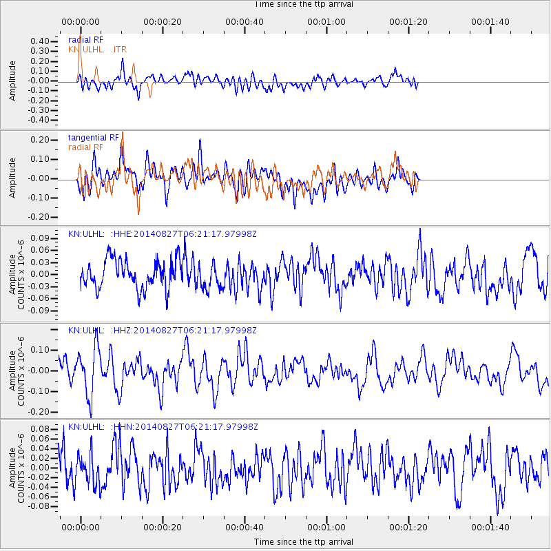
Signal To Noise
| Channel | StoN | STA | LTA |
| KN:ULHL: :HHZ:20140827T06:21:17.97998Z | 2.8958633 | 1.1977995E-7 | 4.1362433E-8 |
| KN:ULHL: :HHN:20140827T06:21:17.97998Z | 1.0963389 | 3.0563847E-8 | 2.78781E-8 |
| KN:ULHL: :HHE:20140827T06:21:17.97998Z | 0.92644596 | 3.224957E-8 | 3.4809986E-8 |
| Arrivals |
| Ps | |
| PpPs | |
| PsPs/PpSs | |


