UMAT Pilot Rock, OR, USA - Earthquake Result Viewer
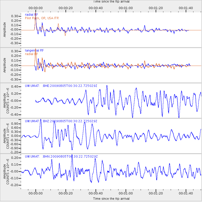
Earthquake location: Southwestern Ryukyu Isl., Japan
Earthquake latitude/longitude: 24.2/125.1
Earthquake time(UTC): 2009/08/05 (217) 00:17:58 GMT
Earthquake Depth: 25 km
Earthquake Magnitude: 5.9 MB, 5.9 MS, 6.2 MW, 6.1 MW
Earthquake Catalog/Contributor: WHDF/NEIC
Network: UW Pacific Northwest Regional Seismic Network
Station: UMAT Pilot Rock, OR, USA
Lat/Lon: 45.29 N/118.96 W
Elevation: 1318 m
Distance: 89.6 deg
Az: 39.403 deg
Baz: 304.823 deg
Ray Param: 0.04173136
Estimated Moho Depth: 35.0 km
Estimated Crust Vp/Vs: 1.81
Assumed Crust Vp: 6.571 km/s
Estimated Crust Vs: 3.64 km/s
Estimated Crust Poisson's Ratio: 0.28
Radial Match: 93.12071 %
Radial Bump: 380
Transverse Match: 84.72315 %
Transverse Bump: 400
SOD ConfigId: 2622
Insert Time: 2010-02-27 05:15:06.727 +0000
GWidth: 2.5
Max Bumps: 400
Tol: 0.001

Signal To Noise

ChannelStoNSTALTA
UW:UMAT: :BHZ:20090805T00:30:22.725029Z9.5868625.324518E-75.553974E-8
UW:UMAT: :BHN:20090805T00:30:22.725029Z1.21032264.3493962E-83.5935845E-8
UW:UMAT: :BHE:20090805T00:30:22.725029Z3.304431.496035E-74.5273616E-8
Arrivals
Ps4.4 SECOND
PpPs15 SECOND
PsPs/PpSs19 SECOND