You are here: Home > Network List > US - United States National Seismic Network Stations List
> Station DGMT Dagmar, Montana, USA > Earthquake Result Viewer
DGMT Dagmar, Montana, USA - Earthquake Result Viewer
*The percent match for this event was below the threshold and hence no stack was calculated.
| Earthquake location: |
El Salvador |
| Earthquake latitude/longitude: |
13.1/-89.2 |
| Earthquake time(UTC): |
2012/08/15 (228) 23:45:52 GMT |
| Earthquake Depth: |
56 km |
| Earthquake Magnitude: |
5.5 MW, 5.6 MD |
| Earthquake Catalog/Contributor: |
NEIC PDE/NEIC PDE-W |
|
| Network: |
US United States National Seismic Network |
| Station: |
DGMT Dagmar, Montana, USA |
| Lat/Lon: |
48.47 N/104.20 W |
| Elevation: |
0.0 m |
|
| Distance: |
37.3 deg |
| Az: |
343.528 deg |
| Baz: |
155.478 deg |
| Ray Param: |
$rayparam |
*The percent match for this event was below the threshold and hence was not used in the summary stack. |
|
| Radial Match: |
60.63127 % |
| Radial Bump: |
400 |
| Transverse Match: |
57.39612 % |
| Transverse Bump: |
400 |
| SOD ConfigId: |
558545 |
| Insert Time: |
2013-09-17 17:11:38.371 +0000 |
| GWidth: |
2.5 |
| Max Bumps: |
400 |
| Tol: |
0.001 |
|
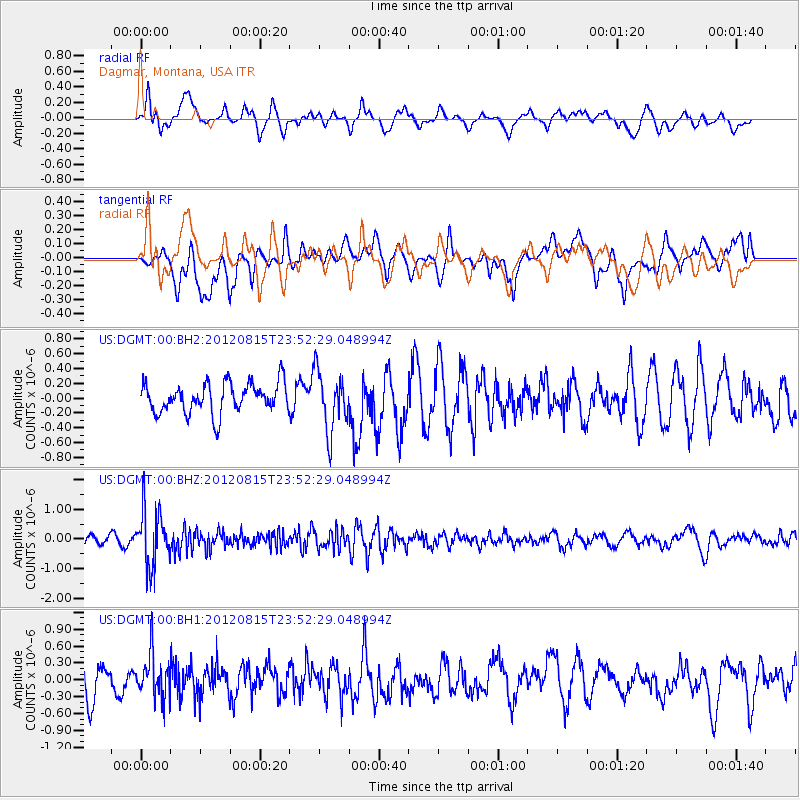
Signal To Noise
| Channel | StoN | STA | LTA |
| US:DGMT:00:BHZ:20120815T23:52:29.048994Z | 5.953103 | 9.33925E-7 | 1.5688038E-7 |
| US:DGMT:00:BH1:20120815T23:52:29.048994Z | 1.3335103 | 3.8725088E-7 | 2.903996E-7 |
| US:DGMT:00:BH2:20120815T23:52:29.048994Z | 1.9821832 | 4.0002726E-7 | 2.0181145E-7 |
| Arrivals |
| Ps | |
| PpPs | |
| PsPs/PpSs | |


