You are here: Home > Network List > US - United States National Seismic Network Stations List
> Station HDIL Hopedale, Illinois, USA > Earthquake Result Viewer
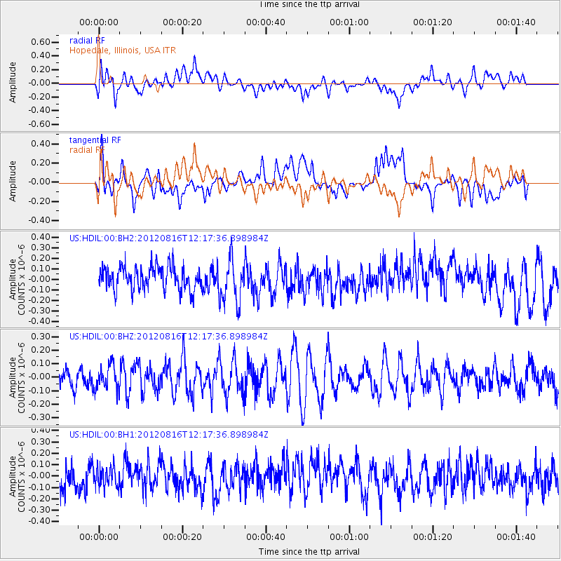
HDIL Hopedale, Illinois, USA - Earthquake Result Viewer
*The percent match for this event was below the threshold and hence no stack was calculated.
| Earthquake location: |
Central Mid-Atlantic Ridge |
| Earthquake latitude/longitude: |
7.3/-36.8 |
| Earthquake time(UTC): |
2012/08/16 (229) 12:08:20 GMT |
| Earthquake Depth: |
10 km |
| Earthquake Magnitude: |
5.6 MW |
| Earthquake Catalog/Contributor: |
NEIC PDE/NEIC PDE-W |
|
| Network: |
US United States National Seismic Network |
| Station: |
HDIL Hopedale, Illinois, USA |
| Lat/Lon: |
40.56 N/89.29 W |
| Elevation: |
219 m |
|
| Distance: |
57.2 deg |
| Az: |
313.986 deg |
| Baz: |
110.493 deg |
| Ray Param: |
$rayparam |
*The percent match for this event was below the threshold and hence was not used in the summary stack. |
|
| Radial Match: |
40.369984 % |
| Radial Bump: |
400 |
| Transverse Match: |
49.20273 % |
| Transverse Bump: |
400 |
| SOD ConfigId: |
558545 |
| Insert Time: |
2013-09-17 17:16:05.061 +0000 |
| GWidth: |
2.5 |
| Max Bumps: |
400 |
| Tol: |
0.001 |
|
Signal To Noise
| Channel | StoN | STA | LTA |
| US:HDIL:00:BHZ:20120816T12:17:36.898984Z | 1.0388081 | 8.910684E-8 | 8.577796E-8 |
| US:HDIL:00:BH1:20120816T12:17:36.898984Z | 0.7751691 | 8.8758384E-8 | 1.1450197E-7 |
| US:HDIL:00:BH2:20120816T12:17:36.898984Z | 1.8753573 | 2.0940826E-7 | 1.1166313E-7 |
| Arrivals |
| Ps | |
| PpPs | |
| PsPs/PpSs | |


