You are here: Home > Network List > US - United States National Seismic Network Stations List
> Station LAO LASA Array, Montana, USA > Earthquake Result Viewer
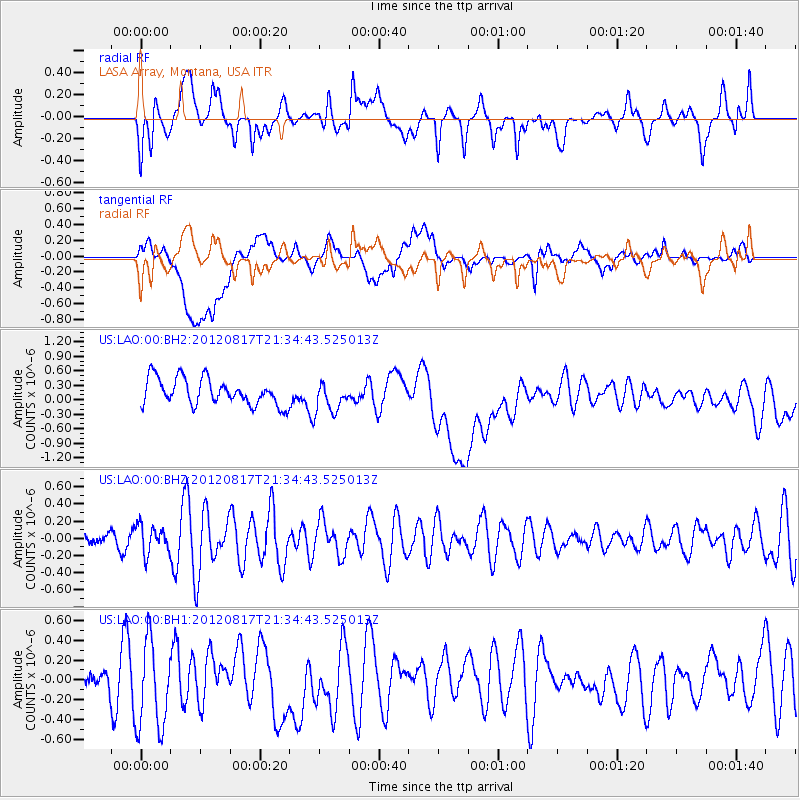
LAO LASA Array, Montana, USA - Earthquake Result Viewer
*The percent match for this event was below the threshold and hence no stack was calculated.
| Earthquake location: |
Northern East Pacific Rise |
| Earthquake latitude/longitude: |
8.3/-103.0 |
| Earthquake time(UTC): |
2012/08/17 (230) 21:27:53 GMT |
| Earthquake Depth: |
10 km |
| Earthquake Magnitude: |
5.5 MW |
| Earthquake Catalog/Contributor: |
NEIC PDE/NEIC PDE-W |
|
| Network: |
US United States National Seismic Network |
| Station: |
LAO LASA Array, Montana, USA |
| Lat/Lon: |
46.69 N/106.22 W |
| Elevation: |
902 m |
|
| Distance: |
38.3 deg |
| Az: |
356.423 deg |
| Baz: |
174.855 deg |
| Ray Param: |
$rayparam |
*The percent match for this event was below the threshold and hence was not used in the summary stack. |
|
| Radial Match: |
53.115974 % |
| Radial Bump: |
400 |
| Transverse Match: |
22.738338 % |
| Transverse Bump: |
400 |
| SOD ConfigId: |
558545 |
| Insert Time: |
2013-09-17 17:24:10.823 +0000 |
| GWidth: |
2.5 |
| Max Bumps: |
400 |
| Tol: |
0.001 |
|
Signal To Noise
| Channel | StoN | STA | LTA |
| US:LAO:00:BHZ:20120817T21:34:43.525013Z | 1.2830297 | 1.6095443E-7 | 1.2544872E-7 |
| US:LAO:00:BH1:20120817T21:34:43.525013Z | 2.403024 | 4.5878897E-7 | 1.9092153E-7 |
| US:LAO:00:BH2:20120817T21:34:43.525013Z | 1.1739343 | 3.2258617E-7 | 2.7479064E-7 |
| Arrivals |
| Ps | |
| PpPs | |
| PsPs/PpSs | |


