You are here: Home > Network List > US - United States National Seismic Network Stations List
> Station COWI Conover, Wisconsin, USA > Earthquake Result Viewer
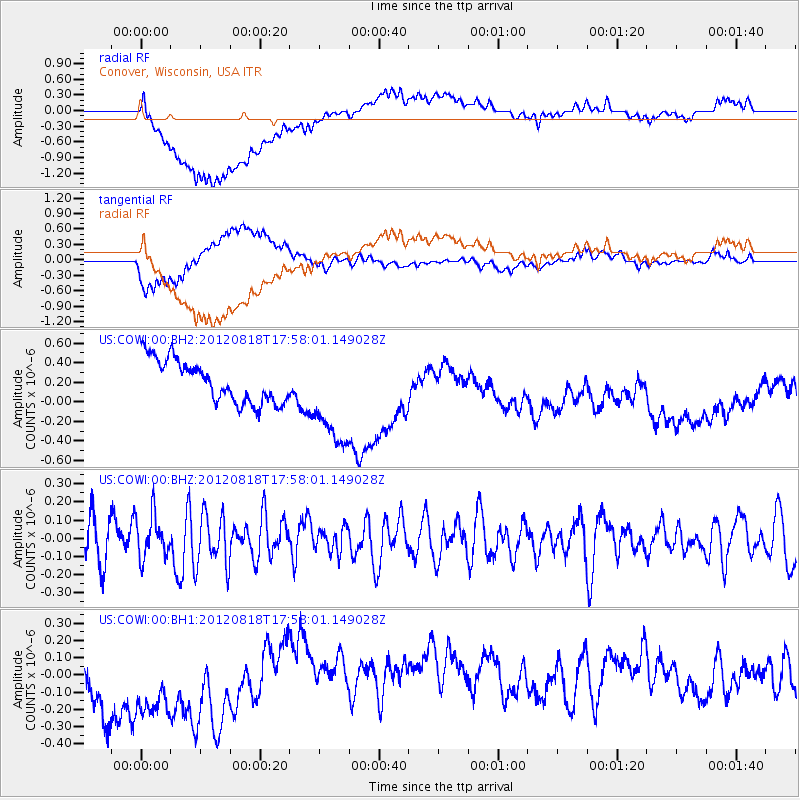
COWI Conover, Wisconsin, USA - Earthquake Result Viewer
*The percent match for this event was below the threshold and hence no stack was calculated.
| Earthquake location: |
Tonga Islands |
| Earthquake latitude/longitude: |
-15.6/-173.0 |
| Earthquake time(UTC): |
2012/08/18 (231) 17:45:02 GMT |
| Earthquake Depth: |
15 km |
| Earthquake Magnitude: |
5.7 MW, 5.4 MS, 5.4 MB, 5.7 MW |
| Earthquake Catalog/Contributor: |
WHDF/NEIC |
|
| Network: |
US United States National Seismic Network |
| Station: |
COWI Conover, Wisconsin, USA |
| Lat/Lon: |
46.10 N/89.14 W |
| Elevation: |
523 m |
|
| Distance: |
96.9 deg |
| Az: |
44.185 deg |
| Baz: |
254.851 deg |
| Ray Param: |
$rayparam |
*The percent match for this event was below the threshold and hence was not used in the summary stack. |
|
| Radial Match: |
53.96421 % |
| Radial Bump: |
400 |
| Transverse Match: |
57.43354 % |
| Transverse Bump: |
400 |
| SOD ConfigId: |
558545 |
| Insert Time: |
2013-09-17 17:33:36.500 +0000 |
| GWidth: |
2.5 |
| Max Bumps: |
400 |
| Tol: |
0.001 |
|
Signal To Noise
| Channel | StoN | STA | LTA |
| US:COWI:00:BHZ:20120818T17:58:01.149028Z | 0.9498748 | 1.1785094E-7 | 1.2406997E-7 |
| US:COWI:00:BH1:20120818T17:58:01.149028Z | 1.3434432 | 3.6973017E-7 | 2.7521088E-7 |
| US:COWI:00:BH2:20120818T17:58:01.149028Z | 2.3085673 | 5.0162583E-7 | 2.172888E-7 |
| Arrivals |
| Ps | |
| PpPs | |
| PsPs/PpSs | |


