You are here: Home > Network List > US - United States National Seismic Network Stations List
> Station DGMT Dagmar, Montana, USA > Earthquake Result Viewer
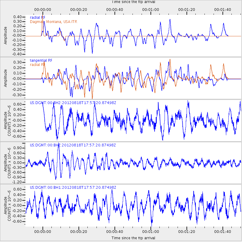
DGMT Dagmar, Montana, USA - Earthquake Result Viewer
*The percent match for this event was below the threshold and hence no stack was calculated.
| Earthquake location: |
Tonga Islands |
| Earthquake latitude/longitude: |
-15.6/-173.0 |
| Earthquake time(UTC): |
2012/08/18 (231) 17:45:02 GMT |
| Earthquake Depth: |
15 km |
| Earthquake Magnitude: |
5.7 MW, 5.4 MS, 5.4 MB, 5.7 MW |
| Earthquake Catalog/Contributor: |
WHDF/NEIC |
|
| Network: |
US United States National Seismic Network |
| Station: |
DGMT Dagmar, Montana, USA |
| Lat/Lon: |
48.47 N/104.20 W |
| Elevation: |
0.0 m |
|
| Distance: |
88.2 deg |
| Az: |
38.388 deg |
| Baz: |
244.049 deg |
| Ray Param: |
$rayparam |
*The percent match for this event was below the threshold and hence was not used in the summary stack. |
|
| Radial Match: |
45.80568 % |
| Radial Bump: |
400 |
| Transverse Match: |
56.061935 % |
| Transverse Bump: |
400 |
| SOD ConfigId: |
558545 |
| Insert Time: |
2013-09-17 17:33:40.273 +0000 |
| GWidth: |
2.5 |
| Max Bumps: |
400 |
| Tol: |
0.001 |
|
Signal To Noise
| Channel | StoN | STA | LTA |
| US:DGMT:00:BHZ:20120818T17:57:20.87498Z | 2.778851 | 2.996832E-7 | 1.07844286E-7 |
| US:DGMT:00:BH1:20120818T17:57:20.87498Z | 1.5581616 | 2.913376E-7 | 1.8697523E-7 |
| US:DGMT:00:BH2:20120818T17:57:20.87498Z | 0.70430547 | 2.2348853E-7 | 3.173176E-7 |
| Arrivals |
| Ps | |
| PpPs | |
| PsPs/PpSs | |


