You are here: Home > Network List > US - United States National Seismic Network Stations List
> Station MSO Missoula, Montana, USA > Earthquake Result Viewer
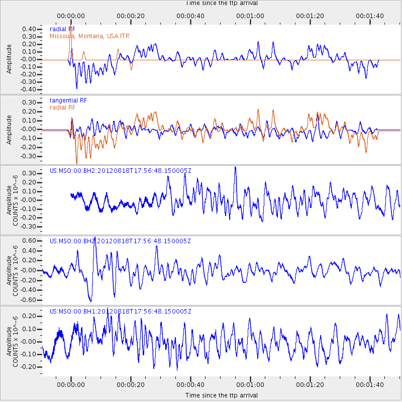
MSO Missoula, Montana, USA - Earthquake Result Viewer
*The percent match for this event was below the threshold and hence no stack was calculated.
| Earthquake location: |
Tonga Islands |
| Earthquake latitude/longitude: |
-15.6/-173.0 |
| Earthquake time(UTC): |
2012/08/18 (231) 17:45:02 GMT |
| Earthquake Depth: |
15 km |
| Earthquake Magnitude: |
5.7 MW, 5.4 MS, 5.4 MB, 5.7 MW |
| Earthquake Catalog/Contributor: |
WHDF/NEIC |
|
| Network: |
US United States National Seismic Network |
| Station: |
MSO Missoula, Montana, USA |
| Lat/Lon: |
46.83 N/113.94 W |
| Elevation: |
1264 m |
|
| Distance: |
81.6 deg |
| Az: |
36.549 deg |
| Baz: |
236.696 deg |
| Ray Param: |
$rayparam |
*The percent match for this event was below the threshold and hence was not used in the summary stack. |
|
| Radial Match: |
58.63194 % |
| Radial Bump: |
383 |
| Transverse Match: |
58.628807 % |
| Transverse Bump: |
400 |
| SOD ConfigId: |
558545 |
| Insert Time: |
2013-09-17 17:34:31.197 +0000 |
| GWidth: |
2.5 |
| Max Bumps: |
400 |
| Tol: |
0.001 |
|
Signal To Noise
| Channel | StoN | STA | LTA |
| US:MSO:00:BHZ:20120818T17:56:48.150005Z | 2.7052426 | 1.6194281E-7 | 5.9862586E-8 |
| US:MSO:00:BH1:20120818T17:56:48.150005Z | 2.0724719 | 1.1765393E-7 | 5.6769856E-8 |
| US:MSO:00:BH2:20120818T17:56:48.150005Z | 2.1862879 | 1.3394903E-7 | 6.126779E-8 |
| Arrivals |
| Ps | |
| PpPs | |
| PsPs/PpSs | |


