You are here: Home > Network List > US - United States National Seismic Network Stations List
> Station HAWA Hanford, Washington, USA > Earthquake Result Viewer
HAWA Hanford, Washington, USA - Earthquake Result Viewer
*The percent match for this event was below the threshold and hence no stack was calculated.
| Earthquake location: |
Near N Coast Of New Guinea, P.N.G. |
| Earthquake latitude/longitude: |
-4.8/144.6 |
| Earthquake time(UTC): |
2012/08/19 (232) 22:41:49 GMT |
| Earthquake Depth: |
73 km |
| Earthquake Magnitude: |
6.0 MB, 6.2 MW, 6.3 MW |
| Earthquake Catalog/Contributor: |
WHDF/NEIC |
|
| Network: |
US United States National Seismic Network |
| Station: |
HAWA Hanford, Washington, USA |
| Lat/Lon: |
46.39 N/119.53 W |
| Elevation: |
364 m |
|
| Distance: |
97.5 deg |
| Az: |
43.98 deg |
| Baz: |
270.97 deg |
| Ray Param: |
$rayparam |
*The percent match for this event was below the threshold and hence was not used in the summary stack. |
|
| Radial Match: |
68.76948 % |
| Radial Bump: |
400 |
| Transverse Match: |
57.18464 % |
| Transverse Bump: |
400 |
| SOD ConfigId: |
558545 |
| Insert Time: |
2013-09-17 17:40:27.470 +0000 |
| GWidth: |
2.5 |
| Max Bumps: |
400 |
| Tol: |
0.001 |
|
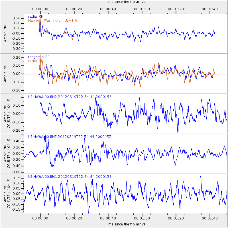
Signal To Noise
| Channel | StoN | STA | LTA |
| US:HAWA:00:BHZ:20120819T22:54:44.200015Z | 4.4216404 | 2.6881557E-7 | 6.0795436E-8 |
| US:HAWA:00:BH1:20120819T22:54:44.200015Z | 1.1190639 | 5.525886E-8 | 4.937954E-8 |
| US:HAWA:00:BH2:20120819T22:54:44.200015Z | 1.5418831 | 9.007878E-8 | 5.8421275E-8 |
| Arrivals |
| Ps | |
| PpPs | |
| PsPs/PpSs | |


