You are here: Home > Network List > II - Global Seismograph Network (GSN - IRIS/IDA) Stations List
> Station NIL Nilore, Pakistan > Earthquake Result Viewer
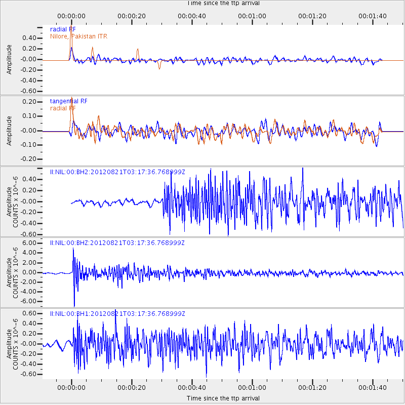
NIL Nilore, Pakistan - Earthquake Result Viewer
*The percent match for this event was below the threshold and hence no stack was calculated.
| Earthquake location: |
Southern Sumatra, Indonesia |
| Earthquake latitude/longitude: |
-4.7/103.0 |
| Earthquake time(UTC): |
2012/08/21 (234) 03:09:39 GMT |
| Earthquake Depth: |
66 km |
| Earthquake Magnitude: |
5.5 MB, 5.2 MW |
| Earthquake Catalog/Contributor: |
WHDF/NEIC |
|
| Network: |
II Global Seismograph Network (GSN - IRIS/IDA) |
| Station: |
NIL Nilore, Pakistan |
| Lat/Lon: |
33.65 N/73.27 E |
| Elevation: |
629 m |
|
| Distance: |
47.4 deg |
| Az: |
325.828 deg |
| Baz: |
137.849 deg |
| Ray Param: |
$rayparam |
*The percent match for this event was below the threshold and hence was not used in the summary stack. |
|
| Radial Match: |
62.44907 % |
| Radial Bump: |
400 |
| Transverse Match: |
58.399136 % |
| Transverse Bump: |
400 |
| SOD ConfigId: |
558545 |
| Insert Time: |
2013-09-17 17:41:02.924 +0000 |
| GWidth: |
2.5 |
| Max Bumps: |
400 |
| Tol: |
0.001 |
|
Signal To Noise
| Channel | StoN | STA | LTA |
| II:NIL:00:BHZ:20120821T03:17:36.768999Z | 17.888412 | 1.9422496E-6 | 1.0857584E-7 |
| II:NIL:00:BH1:20120821T03:17:36.768999Z | 5.707773 | 2.3963736E-7 | 4.1984386E-8 |
| II:NIL:00:BH2:20120821T03:17:36.768999Z | 6.637342 | 2.0555275E-7 | 3.0969137E-8 |
| Arrivals |
| Ps | |
| PpPs | |
| PsPs/PpSs | |


