You are here: Home > Network List > IU - Global Seismograph Network (GSN - IRIS/USGS) Stations List
> Station CTAO Charters Towers, Australia > Earthquake Result Viewer
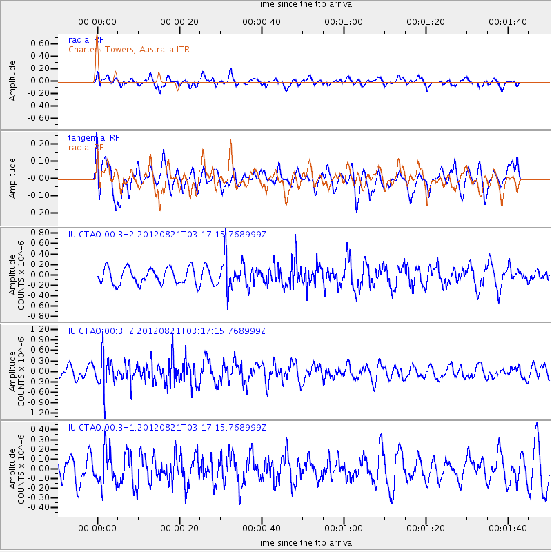
CTAO Charters Towers, Australia - Earthquake Result Viewer
*The percent match for this event was below the threshold and hence no stack was calculated.
| Earthquake location: |
Southern Sumatra, Indonesia |
| Earthquake latitude/longitude: |
-4.7/103.0 |
| Earthquake time(UTC): |
2012/08/21 (234) 03:09:39 GMT |
| Earthquake Depth: |
66 km |
| Earthquake Magnitude: |
5.5 MB, 5.2 MW |
| Earthquake Catalog/Contributor: |
WHDF/NEIC |
|
| Network: |
IU Global Seismograph Network (GSN - IRIS/USGS) |
| Station: |
CTAO Charters Towers, Australia |
| Lat/Lon: |
20.09 S/146.25 E |
| Elevation: |
357 m |
|
| Distance: |
44.7 deg |
| Az: |
113.792 deg |
| Baz: |
284.018 deg |
| Ray Param: |
$rayparam |
*The percent match for this event was below the threshold and hence was not used in the summary stack. |
|
| Radial Match: |
47.590908 % |
| Radial Bump: |
400 |
| Transverse Match: |
62.965412 % |
| Transverse Bump: |
400 |
| SOD ConfigId: |
558545 |
| Insert Time: |
2013-09-17 17:41:24.402 +0000 |
| GWidth: |
2.5 |
| Max Bumps: |
400 |
| Tol: |
0.001 |
|
Signal To Noise
| Channel | StoN | STA | LTA |
| IU:CTAO:00:BHZ:20120821T03:17:15.768999Z | 2.7436972 | 4.6648492E-7 | 1.7002057E-7 |
| IU:CTAO:00:BH1:20120821T03:17:15.768999Z | 1.2787985 | 1.7051661E-7 | 1.3334127E-7 |
| IU:CTAO:00:BH2:20120821T03:17:15.768999Z | 1.9525808 | 2.9395116E-7 | 1.5054495E-7 |
| Arrivals |
| Ps | |
| PpPs | |
| PsPs/PpSs | |


