You are here: Home > Network List > US - United States National Seismic Network Stations List
> Station DGMT Dagmar, Montana, USA > Earthquake Result Viewer
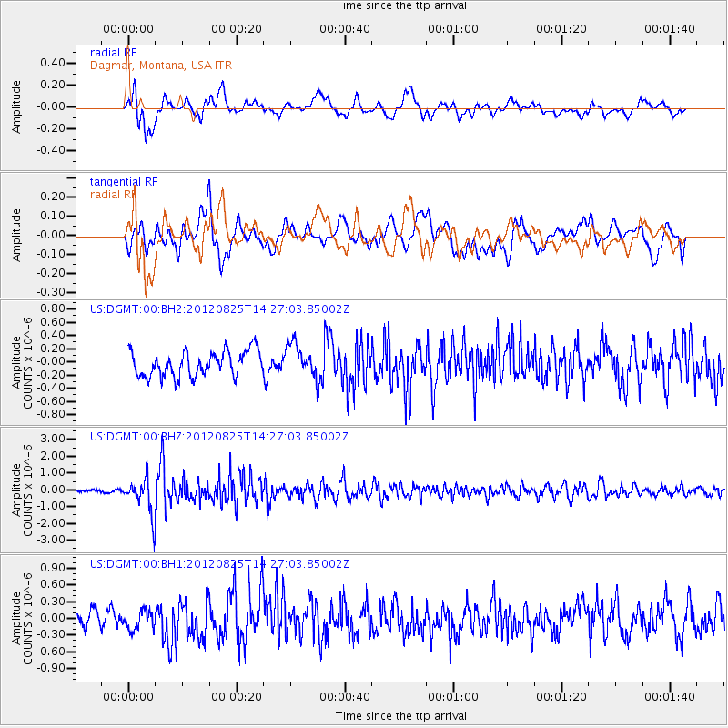
DGMT Dagmar, Montana, USA - Earthquake Result Viewer
*The percent match for this event was below the threshold and hence no stack was calculated.
| Earthquake location: |
Hokkaido, Japan Region |
| Earthquake latitude/longitude: |
42.4/142.9 |
| Earthquake time(UTC): |
2012/08/25 (238) 14:16:17 GMT |
| Earthquake Depth: |
54 km |
| Earthquake Magnitude: |
5.9 MW, 5.9 MB, 5.9 MW |
| Earthquake Catalog/Contributor: |
NEIC PDE/NEIC PDE-W |
|
| Network: |
US United States National Seismic Network |
| Station: |
DGMT Dagmar, Montana, USA |
| Lat/Lon: |
48.47 N/104.20 W |
| Elevation: |
0.0 m |
|
| Distance: |
71.9 deg |
| Az: |
40.154 deg |
| Baz: |
314.152 deg |
| Ray Param: |
$rayparam |
*The percent match for this event was below the threshold and hence was not used in the summary stack. |
|
| Radial Match: |
63.844563 % |
| Radial Bump: |
400 |
| Transverse Match: |
61.905735 % |
| Transverse Bump: |
400 |
| SOD ConfigId: |
558545 |
| Insert Time: |
2013-09-17 17:54:33.187 +0000 |
| GWidth: |
2.5 |
| Max Bumps: |
400 |
| Tol: |
0.001 |
|
Signal To Noise
| Channel | StoN | STA | LTA |
| US:DGMT:00:BHZ:20120825T14:27:03.85002Z | 13.287126 | 1.0966015E-6 | 8.253114E-8 |
| US:DGMT:00:BH1:20120825T14:27:03.85002Z | 1.0882177 | 1.6553963E-7 | 1.5211995E-7 |
| US:DGMT:00:BH2:20120825T14:27:03.85002Z | 1.2455403 | 2.3918633E-7 | 1.9203421E-7 |
| Arrivals |
| Ps | |
| PpPs | |
| PsPs/PpSs | |


