You are here: Home > Network List > IU - Global Seismograph Network (GSN - IRIS/USGS) Stations List
> Station HNR Honiara, Solomon Islands > Earthquake Result Viewer
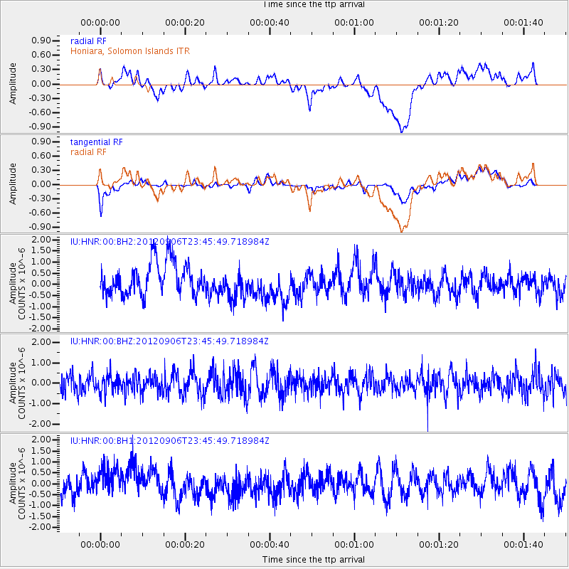
HNR Honiara, Solomon Islands - Earthquake Result Viewer
*The percent match for this event was below the threshold and hence no stack was calculated.
| Earthquake location: |
Central East Pacific Rise |
| Earthquake latitude/longitude: |
-4.6/-105.9 |
| Earthquake time(UTC): |
2012/09/06 (250) 23:33:06 GMT |
| Earthquake Depth: |
10 km |
| Earthquake Magnitude: |
5.8 MW, 5.5 MS, 5.7 MW |
| Earthquake Catalog/Contributor: |
NEIC PDE/NEIC PDE-W |
|
| Network: |
IU Global Seismograph Network (GSN - IRIS/USGS) |
| Station: |
HNR Honiara, Solomon Islands |
| Lat/Lon: |
9.44 S/159.95 E |
| Elevation: |
100 m |
|
| Distance: |
93.3 deg |
| Az: |
260.305 deg |
| Baz: |
95.195 deg |
| Ray Param: |
$rayparam |
*The percent match for this event was below the threshold and hence was not used in the summary stack. |
|
| Radial Match: |
36.67818 % |
| Radial Bump: |
400 |
| Transverse Match: |
45.02211 % |
| Transverse Bump: |
400 |
| SOD ConfigId: |
558545 |
| Insert Time: |
2013-09-17 17:59:08.038 +0000 |
| GWidth: |
2.5 |
| Max Bumps: |
400 |
| Tol: |
0.001 |
|
Signal To Noise
| Channel | StoN | STA | LTA |
| IU:HNR:00:BHZ:20120906T23:45:49.718984Z | 0.77126026 | 4.2649407E-7 | 5.529833E-7 |
| IU:HNR:00:BH1:20120906T23:45:49.718984Z | 1.5498646 | 8.958526E-7 | 5.780199E-7 |
| IU:HNR:00:BH2:20120906T23:45:49.718984Z | 1.0212238 | 7.2359336E-7 | 7.0855515E-7 |
| Arrivals |
| Ps | |
| PpPs | |
| PsPs/PpSs | |


