TATO Taipei, Taiwan - Earthquake Result Viewer
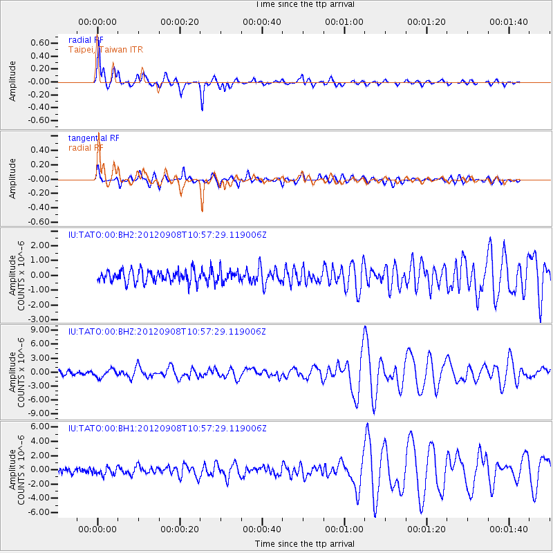
Earthquake location: Irian Jaya Region, Indonesia
Earthquake latitude/longitude: -3.2/135.1
Earthquake time(UTC): 2012/09/08 (252) 10:51:44 GMT
Earthquake Depth: 21 km
Earthquake Magnitude: 6.1 MW, 5.9 MS, 6.1 MW, 6.2 MB
Earthquake Catalog/Contributor: NEIC PDE/NEIC PDE-W
Network: IU Global Seismograph Network (GSN - IRIS/USGS)
Station: TATO Taipei, Taiwan
Lat/Lon: 24.97 N/121.50 E
Elevation: 160 m
Distance: 30.9 deg
Az: 335.459 deg
Baz: 152.81 deg
Ray Param: 0.07918452
Estimated Moho Depth: 25.75 km
Estimated Crust Vp/Vs: 1.93
Assumed Crust Vp: 6.289 km/s
Estimated Crust Vs: 3.254 km/s
Estimated Crust Poisson's Ratio: 0.32
Radial Match: 93.25855 %
Radial Bump: 369
Transverse Match: 76.30429 %
Transverse Bump: 400
SOD ConfigId: 558545
Insert Time: 2013-09-17 18:10:57.338 +0000
GWidth: 2.5
Max Bumps: 400
Tol: 0.001

Signal To Noise

ChannelStoNSTALTA
IU:TATO:00:BHZ:20120908T10:57:29.119006Z1.72268168.5943554E-74.98894E-7
IU:TATO:00:BH1:20120908T10:57:29.119006Z1.10818985.239291E-74.7277922E-7
IU:TATO:00:BH2:20120908T10:57:29.119006Z0.921226863.7533334E-74.074277E-7
Arrivals
Ps4.1 SECOND
PpPs11 SECOND
PsPs/PpSs15 SECOND