You are here: Home > Network List > UW - Pacific Northwest Regional Seismic Network Stations List
> Station UMAT Pilot Rock, OR, USA > Earthquake Result Viewer
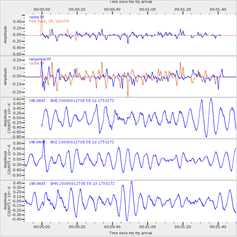
UMAT Pilot Rock, OR, USA - Earthquake Result Viewer
*The percent match for this event was below the threshold and hence no stack was calculated.
| Earthquake location: |
Kuril Islands |
| Earthquake latitude/longitude: |
48.3/154.2 |
| Earthquake time(UTC): |
2009/09/11 (254) 08:49:11 GMT |
| Earthquake Depth: |
35 km |
| Earthquake Magnitude: |
5.8 MB, 5.0 MS, 5.6 MW, 5.6 MW |
| Earthquake Catalog/Contributor: |
WHDF/NEIC |
|
| Network: |
UW Pacific Northwest Regional Seismic Network |
| Station: |
UMAT Pilot Rock, OR, USA |
| Lat/Lon: |
45.29 N/118.96 W |
| Elevation: |
1318 m |
|
| Distance: |
56.4 deg |
| Az: |
57.804 deg |
| Baz: |
306.817 deg |
| Ray Param: |
$rayparam |
*The percent match for this event was below the threshold and hence was not used in the summary stack. |
|
| Radial Match: |
56.376556 % |
| Radial Bump: |
349 |
| Transverse Match: |
66.95958 % |
| Transverse Bump: |
400 |
| SOD ConfigId: |
2622 |
| Insert Time: |
2010-02-27 05:16:50.561 +0000 |
| GWidth: |
2.5 |
| Max Bumps: |
400 |
| Tol: |
0.001 |
|
Signal To Noise
| Channel | StoN | STA | LTA |
| UW:UMAT: :BHZ:20090911T08:58:19.175027Z | 3.1948543 | 4.8052675E-7 | 1.5040646E-7 |
| UW:UMAT: :BHN:20090911T08:58:19.175027Z | 0.8744612 | 1.0391431E-7 | 1.1883239E-7 |
| UW:UMAT: :BHE:20090911T08:58:19.175027Z | 1.535275 | 3.679376E-7 | 2.396558E-7 |
| Arrivals |
| Ps | |
| PpPs | |
| PsPs/PpSs | |


