You are here: Home > Network List > II - Global Seismograph Network (GSN - IRIS/IDA) Stations List
> Station KAPI Kappang, Sulawesi, Indonesia > Earthquake Result Viewer
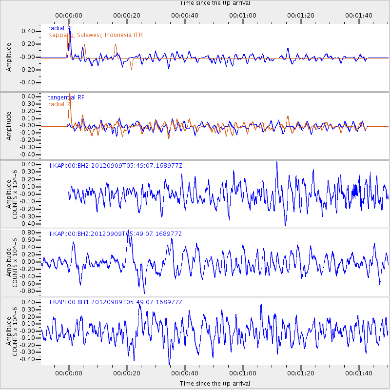
KAPI Kappang, Sulawesi, Indonesia - Earthquake Result Viewer
*The percent match for this event was below the threshold and hence no stack was calculated.
| Earthquake location: |
Kuril Islands |
| Earthquake latitude/longitude: |
49.4/155.5 |
| Earthquake time(UTC): |
2012/09/09 (253) 05:39:18 GMT |
| Earthquake Depth: |
35 km |
| Earthquake Magnitude: |
6.0 MW |
| Earthquake Catalog/Contributor: |
NEIC PDE/NEIC PDE-W |
|
| Network: |
II Global Seismograph Network (GSN - IRIS/IDA) |
| Station: |
KAPI Kappang, Sulawesi, Indonesia |
| Lat/Lon: |
5.01 S/119.75 E |
| Elevation: |
300 m |
|
| Distance: |
62.5 deg |
| Az: |
221.037 deg |
| Baz: |
25.487 deg |
| Ray Param: |
$rayparam |
*The percent match for this event was below the threshold and hence was not used in the summary stack. |
|
| Radial Match: |
63.335693 % |
| Radial Bump: |
400 |
| Transverse Match: |
58.2645 % |
| Transverse Bump: |
400 |
| SOD ConfigId: |
558545 |
| Insert Time: |
2013-09-17 18:14:53.164 +0000 |
| GWidth: |
2.5 |
| Max Bumps: |
400 |
| Tol: |
0.001 |
|
Signal To Noise
| Channel | StoN | STA | LTA |
| II:KAPI:00:BHZ:20120909T05:49:07.168977Z | 2.5865247 | 2.9797758E-7 | 1.1520385E-7 |
| II:KAPI:00:BH1:20120909T05:49:07.168977Z | 1.0600109 | 1.1313934E-7 | 1.0673413E-7 |
| II:KAPI:00:BH2:20120909T05:49:07.168977Z | 1.4345281 | 1.2366203E-7 | 8.6203976E-8 |
| Arrivals |
| Ps | |
| PpPs | |
| PsPs/PpSs | |


