You are here: Home > Network List > IU - Global Seismograph Network (GSN - IRIS/USGS) Stations List
> Station POHA Pohakuloa, Hawaii, USA > Earthquake Result Viewer
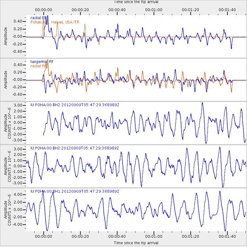
POHA Pohakuloa, Hawaii, USA - Earthquake Result Viewer
*The percent match for this event was below the threshold and hence no stack was calculated.
| Earthquake location: |
Kuril Islands |
| Earthquake latitude/longitude: |
49.4/155.5 |
| Earthquake time(UTC): |
2012/09/09 (253) 05:39:18 GMT |
| Earthquake Depth: |
35 km |
| Earthquake Magnitude: |
6.0 MW |
| Earthquake Catalog/Contributor: |
NEIC PDE/NEIC PDE-W |
|
| Network: |
IU Global Seismograph Network (GSN - IRIS/USGS) |
| Station: |
POHA Pohakuloa, Hawaii, USA |
| Lat/Lon: |
19.76 N/155.53 W |
| Elevation: |
1990 m |
|
| Distance: |
48.8 deg |
| Az: |
109.324 deg |
| Baz: |
319.142 deg |
| Ray Param: |
$rayparam |
*The percent match for this event was below the threshold and hence was not used in the summary stack. |
|
| Radial Match: |
32.641457 % |
| Radial Bump: |
400 |
| Transverse Match: |
54.01783 % |
| Transverse Bump: |
400 |
| SOD ConfigId: |
558545 |
| Insert Time: |
2013-09-17 18:16:21.768 +0000 |
| GWidth: |
2.5 |
| Max Bumps: |
400 |
| Tol: |
0.001 |
|
Signal To Noise
| Channel | StoN | STA | LTA |
| IU:POHA:00:BHZ:20120909T05:47:29.368989Z | 1.4383872 | 1.2025655E-6 | 8.3605136E-7 |
| IU:POHA:00:BH1:20120909T05:47:29.368989Z | 2.22456 | 3.732467E-6 | 1.677845E-6 |
| IU:POHA:00:BH2:20120909T05:47:29.368989Z | 0.59092385 | 5.910142E-7 | 1.000153E-6 |
| Arrivals |
| Ps | |
| PpPs | |
| PsPs/PpSs | |


