You are here: Home > Network List > US - United States National Seismic Network Stations List
> Station AMTX Amarillo, Texas, USA > Earthquake Result Viewer
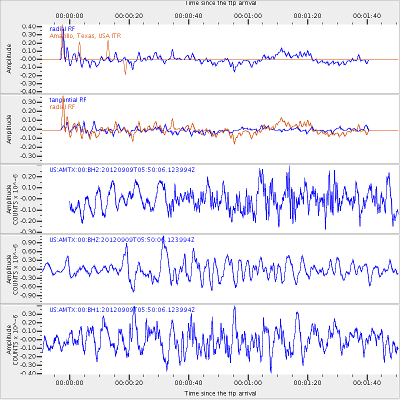
AMTX Amarillo, Texas, USA - Earthquake Result Viewer
*The percent match for this event was below the threshold and hence no stack was calculated.
| Earthquake location: |
Kuril Islands |
| Earthquake latitude/longitude: |
49.4/155.5 |
| Earthquake time(UTC): |
2012/09/09 (253) 05:39:18 GMT |
| Earthquake Depth: |
35 km |
| Earthquake Magnitude: |
6.0 MW |
| Earthquake Catalog/Contributor: |
NEIC PDE/NEIC PDE-W |
|
| Network: |
US United States National Seismic Network |
| Station: |
AMTX Amarillo, Texas, USA |
| Lat/Lon: |
34.53 N/101.41 W |
| Elevation: |
1010 m |
|
| Distance: |
72.2 deg |
| Az: |
57.624 deg |
| Baz: |
318.093 deg |
| Ray Param: |
$rayparam |
*The percent match for this event was below the threshold and hence was not used in the summary stack. |
|
| Radial Match: |
68.84507 % |
| Radial Bump: |
400 |
| Transverse Match: |
49.988377 % |
| Transverse Bump: |
400 |
| SOD ConfigId: |
558545 |
| Insert Time: |
2013-09-17 18:17:09.330 +0000 |
| GWidth: |
2.5 |
| Max Bumps: |
400 |
| Tol: |
0.001 |
|
Signal To Noise
| Channel | StoN | STA | LTA |
| US:AMTX:00:BHZ:20120909T05:50:06.123994Z | 1.9614292 | 1.9699091E-7 | 1.0043233E-7 |
| US:AMTX:00:BH1:20120909T05:50:06.123994Z | 1.09107 | 8.7406505E-8 | 8.011081E-8 |
| US:AMTX:00:BH2:20120909T05:50:06.123994Z | 0.8726646 | 7.683265E-8 | 8.8043734E-8 |
| Arrivals |
| Ps | |
| PpPs | |
| PsPs/PpSs | |


