You are here: Home > Network List > US - United States National Seismic Network Stations List
> Station ERPA Erie, Pennsylvania, USA > Earthquake Result Viewer
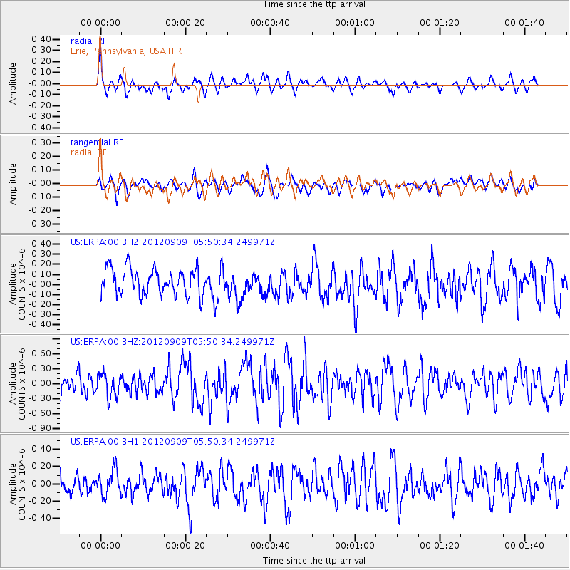
ERPA Erie, Pennsylvania, USA - Earthquake Result Viewer
*The percent match for this event was below the threshold and hence no stack was calculated.
| Earthquake location: |
Kuril Islands |
| Earthquake latitude/longitude: |
49.4/155.5 |
| Earthquake time(UTC): |
2012/09/09 (253) 05:39:18 GMT |
| Earthquake Depth: |
35 km |
| Earthquake Magnitude: |
6.0 MW |
| Earthquake Catalog/Contributor: |
NEIC PDE/NEIC PDE-W |
|
| Network: |
US United States National Seismic Network |
| Station: |
ERPA Erie, Pennsylvania, USA |
| Lat/Lon: |
42.12 N/79.99 W |
| Elevation: |
306 m |
|
| Distance: |
76.6 deg |
| Az: |
39.068 deg |
| Baz: |
326.42 deg |
| Ray Param: |
$rayparam |
*The percent match for this event was below the threshold and hence was not used in the summary stack. |
|
| Radial Match: |
45.2933 % |
| Radial Bump: |
385 |
| Transverse Match: |
53.505104 % |
| Transverse Bump: |
400 |
| SOD ConfigId: |
558545 |
| Insert Time: |
2013-09-17 18:17:42.700 +0000 |
| GWidth: |
2.5 |
| Max Bumps: |
400 |
| Tol: |
0.001 |
|
Signal To Noise
| Channel | StoN | STA | LTA |
| US:ERPA:00:BHZ:20120909T05:50:34.249971Z | 1.3012555 | 2.3054062E-7 | 1.7716785E-7 |
| US:ERPA:00:BH1:20120909T05:50:34.249971Z | 0.98304886 | 1.5012246E-7 | 1.5271108E-7 |
| US:ERPA:00:BH2:20120909T05:50:34.249971Z | 1.1096218 | 1.4045938E-7 | 1.2658312E-7 |
| Arrivals |
| Ps | |
| PpPs | |
| PsPs/PpSs | |


