You are here: Home > Network List > US - United States National Seismic Network Stations List
> Station HAWA Hanford, Washington, USA > Earthquake Result Viewer
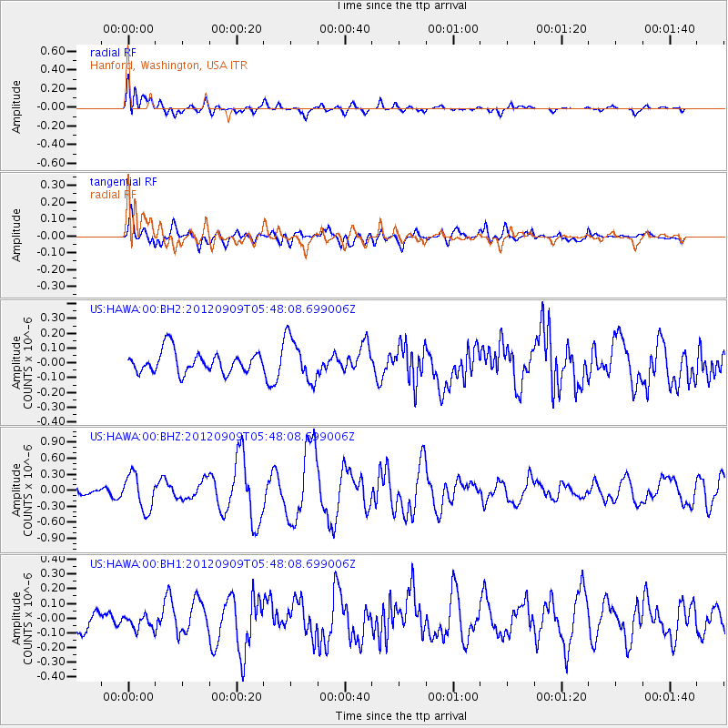
HAWA Hanford, Washington, USA - Earthquake Result Viewer
*The percent match for this event was below the threshold and hence no stack was calculated.
| Earthquake location: |
Kuril Islands |
| Earthquake latitude/longitude: |
49.4/155.5 |
| Earthquake time(UTC): |
2012/09/09 (253) 05:39:18 GMT |
| Earthquake Depth: |
35 km |
| Earthquake Magnitude: |
6.0 MW |
| Earthquake Catalog/Contributor: |
NEIC PDE/NEIC PDE-W |
|
| Network: |
US United States National Seismic Network |
| Station: |
HAWA Hanford, Washington, USA |
| Lat/Lon: |
46.39 N/119.53 W |
| Elevation: |
364 m |
|
| Distance: |
54.1 deg |
| Az: |
58.342 deg |
| Baz: |
306.584 deg |
| Ray Param: |
$rayparam |
*The percent match for this event was below the threshold and hence was not used in the summary stack. |
|
| Radial Match: |
65.497185 % |
| Radial Bump: |
400 |
| Transverse Match: |
65.247 % |
| Transverse Bump: |
400 |
| SOD ConfigId: |
558545 |
| Insert Time: |
2013-09-17 18:17:52.152 +0000 |
| GWidth: |
2.5 |
| Max Bumps: |
400 |
| Tol: |
0.001 |
|
Signal To Noise
| Channel | StoN | STA | LTA |
| US:HAWA:00:BHZ:20120909T05:48:08.699006Z | 2.2671742 | 3.373918E-7 | 1.48816E-7 |
| US:HAWA:00:BH1:20120909T05:48:08.699006Z | 0.54901534 | 4.7211007E-8 | 8.599214E-8 |
| US:HAWA:00:BH2:20120909T05:48:08.699006Z | 2.0501602 | 1.4672338E-7 | 7.1566795E-8 |
| Arrivals |
| Ps | |
| PpPs | |
| PsPs/PpSs | |


