You are here: Home > Network List > US - United States National Seismic Network Stations List
> Station WMOK Wichita Mountains, Oklahoma, USA > Earthquake Result Viewer
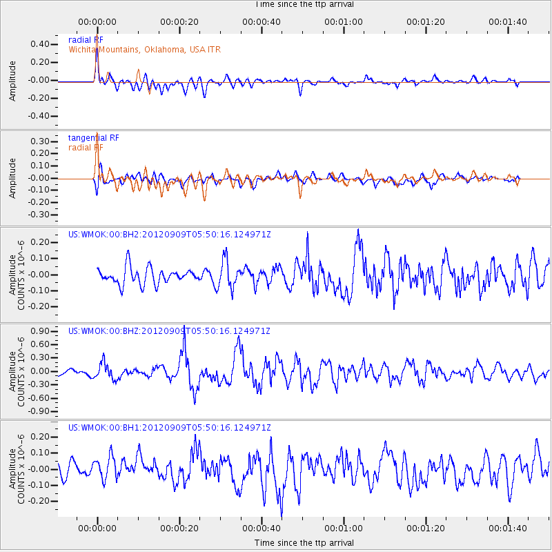
WMOK Wichita Mountains, Oklahoma, USA - Earthquake Result Viewer
*The percent match for this event was below the threshold and hence no stack was calculated.
| Earthquake location: |
Kuril Islands |
| Earthquake latitude/longitude: |
49.4/155.5 |
| Earthquake time(UTC): |
2012/09/09 (253) 05:39:18 GMT |
| Earthquake Depth: |
35 km |
| Earthquake Magnitude: |
6.0 MW |
| Earthquake Catalog/Contributor: |
NEIC PDE/NEIC PDE-W |
|
| Network: |
US United States National Seismic Network |
| Station: |
WMOK Wichita Mountains, Oklahoma, USA |
| Lat/Lon: |
34.74 N/98.78 W |
| Elevation: |
486 m |
|
| Distance: |
73.5 deg |
| Az: |
55.781 deg |
| Baz: |
319.036 deg |
| Ray Param: |
$rayparam |
*The percent match for this event was below the threshold and hence was not used in the summary stack. |
|
| Radial Match: |
62.01049 % |
| Radial Bump: |
400 |
| Transverse Match: |
51.907475 % |
| Transverse Bump: |
400 |
| SOD ConfigId: |
558545 |
| Insert Time: |
2013-09-17 18:18:58.635 +0000 |
| GWidth: |
2.5 |
| Max Bumps: |
400 |
| Tol: |
0.001 |
|
Signal To Noise
| Channel | StoN | STA | LTA |
| US:WMOK:00:BHZ:20120909T05:50:16.124971Z | 2.8907418 | 1.816073E-7 | 6.282377E-8 |
| US:WMOK:00:BH1:20120909T05:50:16.124971Z | 1.4239634 | 8.3261526E-8 | 5.8471677E-8 |
| US:WMOK:00:BH2:20120909T05:50:16.124971Z | 1.7763165 | 8.843223E-8 | 4.9784052E-8 |
| Arrivals |
| Ps | |
| PpPs | |
| PsPs/PpSs | |


