You are here: Home > Network List > US - United States National Seismic Network Stations List
> Station AGMN Agassiz National Wildlife Refuge, Minnesota, USA > Earthquake Result Viewer
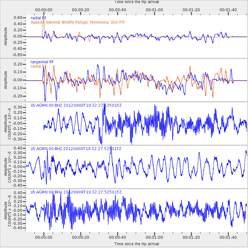
AGMN Agassiz National Wildlife Refuge, Minnesota, USA - Earthquake Result Viewer
*The percent match for this event was below the threshold and hence no stack was calculated.
| Earthquake location: |
Rat Islands, Aleutian Islands |
| Earthquake latitude/longitude: |
52.8/175.0 |
| Earthquake time(UTC): |
2012/09/09 (253) 19:23:51 GMT |
| Earthquake Depth: |
116 km |
| Earthquake Magnitude: |
5.5 MW, 5.5 MW |
| Earthquake Catalog/Contributor: |
NEIC PDE/NEIC PDE-W |
|
| Network: |
US United States National Seismic Network |
| Station: |
AGMN Agassiz National Wildlife Refuge, Minnesota, USA |
| Lat/Lon: |
48.30 N/95.86 W |
| Elevation: |
351 m |
|
| Distance: |
53.3 deg |
| Az: |
56.37 deg |
| Baz: |
310.761 deg |
| Ray Param: |
$rayparam |
*The percent match for this event was below the threshold and hence was not used in the summary stack. |
|
| Radial Match: |
42.749146 % |
| Radial Bump: |
400 |
| Transverse Match: |
47.28252 % |
| Transverse Bump: |
400 |
| SOD ConfigId: |
558545 |
| Insert Time: |
2013-09-17 18:21:36.721 +0000 |
| GWidth: |
2.5 |
| Max Bumps: |
400 |
| Tol: |
0.001 |
|
Signal To Noise
| Channel | StoN | STA | LTA |
| US:AGMN:00:BHZ:20120909T19:32:27.525015Z | 1.699938 | 1.7557844E-7 | 1.03285196E-7 |
| US:AGMN:00:BH1:20120909T19:32:27.525015Z | 1.5938181 | 1.6384844E-7 | 1.02802474E-7 |
| US:AGMN:00:BH2:20120909T19:32:27.525015Z | 1.9649379 | 2.1092887E-7 | 1.0734633E-7 |
| Arrivals |
| Ps | |
| PpPs | |
| PsPs/PpSs | |


