You are here: Home > Network List > UW - Pacific Northwest Regional Seismic Network Stations List
> Station UMAT Pilot Rock, OR, USA > Earthquake Result Viewer
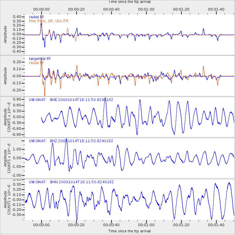
UMAT Pilot Rock, OR, USA - Earthquake Result Viewer
*The percent match for this event was below the threshold and hence no stack was calculated.
| Earthquake location: |
Samoa Islands Region |
| Earthquake latitude/longitude: |
-14.9/-174.8 |
| Earthquake time(UTC): |
2009/10/14 (287) 18:00:21 GMT |
| Earthquake Depth: |
10 km |
| Earthquake Magnitude: |
5.7 MB, 6.0 MS, 6.3 MW, 6.2 MW |
| Earthquake Catalog/Contributor: |
WHDF/NEIC |
|
| Network: |
UW Pacific Northwest Regional Seismic Network |
| Station: |
UMAT Pilot Rock, OR, USA |
| Lat/Lon: |
45.29 N/118.96 W |
| Elevation: |
1318 m |
|
| Distance: |
78.4 deg |
| Az: |
36.623 deg |
| Baz: |
234.786 deg |
| Ray Param: |
$rayparam |
*The percent match for this event was below the threshold and hence was not used in the summary stack. |
|
| Radial Match: |
69.883354 % |
| Radial Bump: |
297 |
| Transverse Match: |
63.0171 % |
| Transverse Bump: |
352 |
| SOD ConfigId: |
2622 |
| Insert Time: |
2010-02-27 05:16:58.664 +0000 |
| GWidth: |
2.5 |
| Max Bumps: |
400 |
| Tol: |
0.001 |
|
Signal To Noise
| Channel | StoN | STA | LTA |
| UW:UMAT: :BHZ:20091014T18:11:50.824016Z | 2.5398228 | 5.4813876E-7 | 2.1581772E-7 |
| UW:UMAT: :BHN:20091014T18:11:50.824016Z | 0.98023903 | 1.3674598E-7 | 1.3950267E-7 |
| UW:UMAT: :BHE:20091014T18:11:50.824016Z | 1.3419176 | 3.2653904E-7 | 2.433376E-7 |
| Arrivals |
| Ps | |
| PpPs | |
| PsPs/PpSs | |


