You are here: Home > Network List > US - United States National Seismic Network Stations List
> Station HDIL Hopedale, Illinois, USA > Earthquake Result Viewer
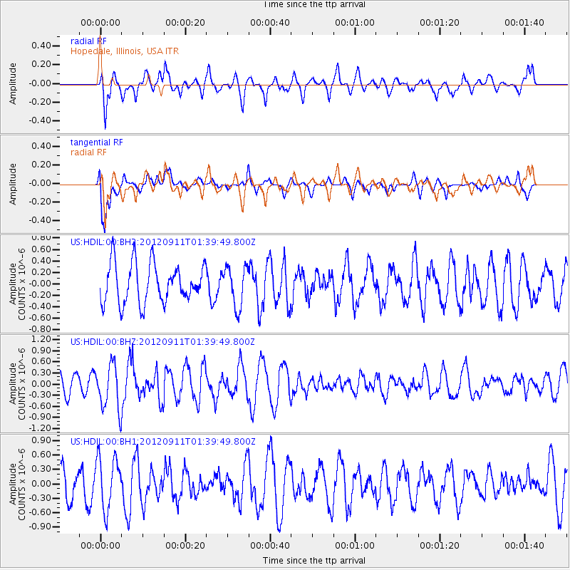
HDIL Hopedale, Illinois, USA - Earthquake Result Viewer
*The percent match for this event was below the threshold and hence no stack was calculated.
| Earthquake location: |
Kuril Islands |
| Earthquake latitude/longitude: |
45.3/151.1 |
| Earthquake time(UTC): |
2012/09/11 (255) 01:28:18 GMT |
| Earthquake Depth: |
14 km |
| Earthquake Magnitude: |
5.6 MW, 5.5 MW |
| Earthquake Catalog/Contributor: |
NEIC PDE/NEIC PDE-W |
|
| Network: |
US United States National Seismic Network |
| Station: |
HDIL Hopedale, Illinois, USA |
| Lat/Lon: |
40.56 N/89.29 W |
| Elevation: |
219 m |
|
| Distance: |
78.8 deg |
| Az: |
42.478 deg |
| Baz: |
321.306 deg |
| Ray Param: |
$rayparam |
*The percent match for this event was below the threshold and hence was not used in the summary stack. |
|
| Radial Match: |
56.29257 % |
| Radial Bump: |
400 |
| Transverse Match: |
60.49227 % |
| Transverse Bump: |
400 |
| SOD ConfigId: |
558545 |
| Insert Time: |
2013-09-17 18:27:05.305 +0000 |
| GWidth: |
2.5 |
| Max Bumps: |
400 |
| Tol: |
0.001 |
|
Signal To Noise
| Channel | StoN | STA | LTA |
| US:HDIL:00:BHZ:20120911T01:39:49.800Z | 1.7818344 | 6.1977784E-7 | 3.4783133E-7 |
| US:HDIL:00:BH1:20120911T01:39:49.800Z | 1.812248 | 5.505859E-7 | 3.0381378E-7 |
| US:HDIL:00:BH2:20120911T01:39:49.800Z | 1.0317909 | 3.5623665E-7 | 3.4526053E-7 |
| Arrivals |
| Ps | |
| PpPs | |
| PsPs/PpSs | |


