You are here: Home > Network List > US - United States National Seismic Network Stations List
> Station HLID Hailey, Idaho, USA > Earthquake Result Viewer
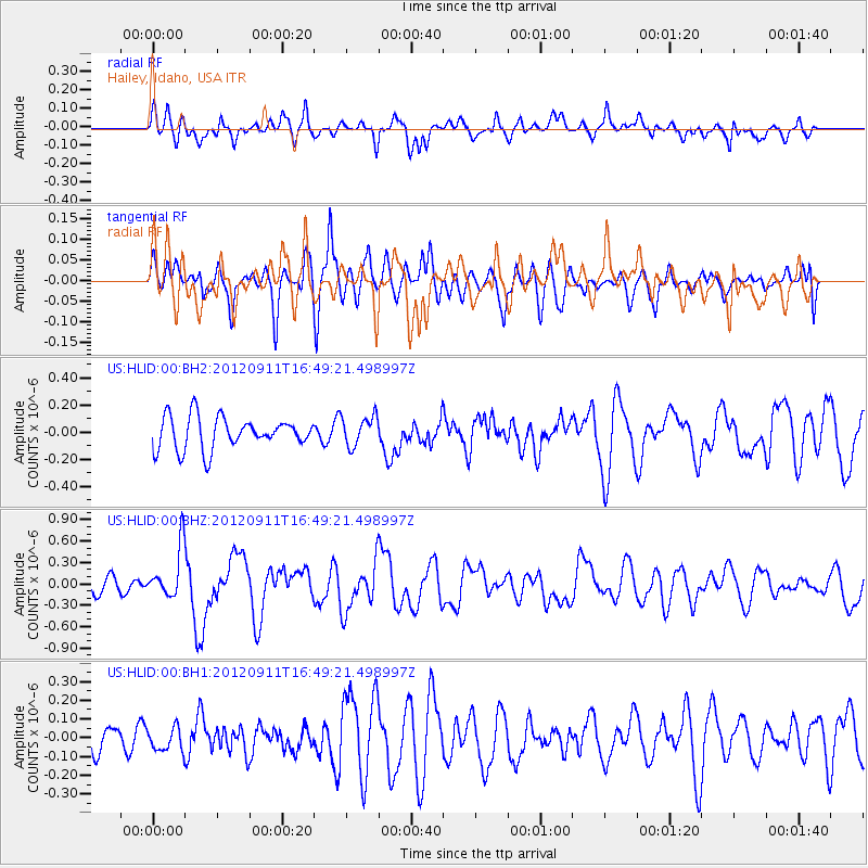
HLID Hailey, Idaho, USA - Earthquake Result Viewer
*The percent match for this event was below the threshold and hence no stack was calculated.
| Earthquake location: |
South Of Mariana Islands |
| Earthquake latitude/longitude: |
11.8/143.2 |
| Earthquake time(UTC): |
2012/09/11 (255) 16:36:49 GMT |
| Earthquake Depth: |
8.0 km |
| Earthquake Magnitude: |
5.8 MB, 5.7 MS, 5.9 MW, 5.8 MW |
| Earthquake Catalog/Contributor: |
WHDF/NEIC |
|
| Network: |
US United States National Seismic Network |
| Station: |
HLID Hailey, Idaho, USA |
| Lat/Lon: |
43.56 N/114.41 W |
| Elevation: |
1772 m |
|
| Distance: |
90.7 deg |
| Az: |
45.244 deg |
| Baz: |
286.989 deg |
| Ray Param: |
$rayparam |
*The percent match for this event was below the threshold and hence was not used in the summary stack. |
|
| Radial Match: |
68.581 % |
| Radial Bump: |
400 |
| Transverse Match: |
49.489838 % |
| Transverse Bump: |
400 |
| SOD ConfigId: |
558545 |
| Insert Time: |
2013-09-17 18:30:41.642 +0000 |
| GWidth: |
2.5 |
| Max Bumps: |
400 |
| Tol: |
0.001 |
|
Signal To Noise
| Channel | StoN | STA | LTA |
| US:HLID:00:BHZ:20120911T16:49:21.498997Z | 2.5949664 | 3.521336E-7 | 1.3569871E-7 |
| US:HLID:00:BH1:20120911T16:49:21.498997Z | 0.67334056 | 6.191935E-8 | 9.195844E-8 |
| US:HLID:00:BH2:20120911T16:49:21.498997Z | 0.94614375 | 1.1180645E-7 | 1.1817068E-7 |
| Arrivals |
| Ps | |
| PpPs | |
| PsPs/PpSs | |


