ABPO Ambohimpanompo, Madagascar - Earthquake Result Viewer
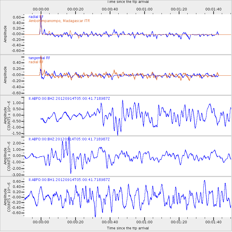
Earthquake location: Southern Sumatra, Indonesia
Earthquake latitude/longitude: -3.3/100.6
Earthquake time(UTC): 2012/09/14 (258) 04:51:47 GMT
Earthquake Depth: 19 km
Earthquake Magnitude: 6.1 MB, 6.3 MS, 6.2 MW, 6.2 MW
Earthquake Catalog/Contributor: WHDF/NEIC
Network: II Global Seismograph Network (GSN - IRIS/IDA)
Station: ABPO Ambohimpanompo, Madagascar
Lat/Lon: 19.02 S/47.23 E
Elevation: 1528 m
Distance: 54.4 deg
Az: 249.034 deg
Baz: 80.188 deg
Ray Param: 0.0654559
Estimated Moho Depth: 16.0 km
Estimated Crust Vp/Vs: 1.83
Assumed Crust Vp: 6.642 km/s
Estimated Crust Vs: 3.639 km/s
Estimated Crust Poisson's Ratio: 0.29
Radial Match: 86.01257 %
Radial Bump: 329
Transverse Match: 60.31244 %
Transverse Bump: 400
SOD ConfigId: 558545
Insert Time: 2013-09-17 18:39:35.697 +0000
GWidth: 2.5
Max Bumps: 400
Tol: 0.001

Signal To Noise

ChannelStoNSTALTA
II:ABPO:00:BHZ:20120914T05:00:41.718987Z2.6671916.2769084E-72.3533781E-7
II:ABPO:00:BH1:20120914T05:00:41.718987Z0.87119082.0418345E-72.3437283E-7
II:ABPO:00:BH2:20120914T05:00:41.718987Z1.94588664.3743498E-72.2479983E-7
Arrivals
Ps2.1 SECOND
PpPs6.4 SECOND
PsPs/PpSs8.5 SECOND