GNI Garni, Armenia - Earthquake Result Viewer
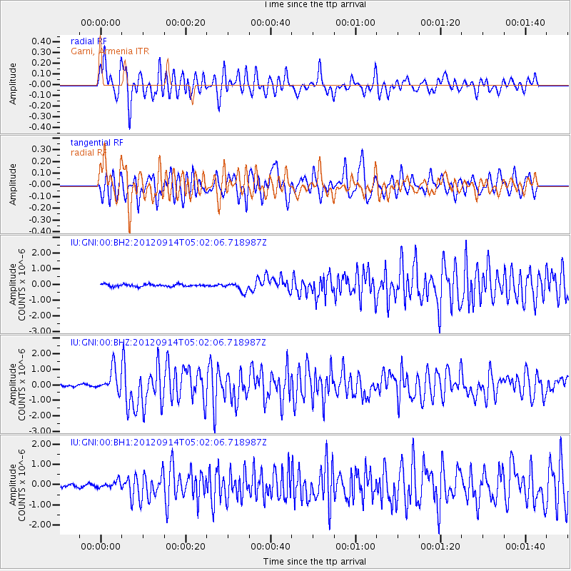
Earthquake location: Southern Sumatra, Indonesia
Earthquake latitude/longitude: -3.3/100.6
Earthquake time(UTC): 2012/09/14 (258) 04:51:47 GMT
Earthquake Depth: 19 km
Earthquake Magnitude: 6.1 MB, 6.3 MS, 6.2 MW, 6.2 MW
Earthquake Catalog/Contributor: WHDF/NEIC
Network: IU Global Seismograph Network (GSN - IRIS/USGS)
Station: GNI Garni, Armenia
Lat/Lon: 40.15 N/44.74 E
Elevation: 1609 m
Distance: 66.9 deg
Az: 316.39 deg
Baz: 116.056 deg
Ray Param: 0.057301395
Estimated Moho Depth: 14.0 km
Estimated Crust Vp/Vs: 1.60
Assumed Crust Vp: 6.291 km/s
Estimated Crust Vs: 3.926 km/s
Estimated Crust Poisson's Ratio: 0.18
Radial Match: 83.92227 %
Radial Bump: 400
Transverse Match: 68.85709 %
Transverse Bump: 400
SOD ConfigId: 558545
Insert Time: 2013-09-17 18:40:21.256 +0000
GWidth: 2.5
Max Bumps: 400
Tol: 0.001

Signal To Noise

ChannelStoNSTALTA
IU:GNI:00:BHZ:20120914T05:02:06.718987Z12.155277.7827303E-76.4027624E-8
IU:GNI:00:BH1:20120914T05:02:06.718987Z2.23177621.8099992E-78.110128E-8
IU:GNI:00:BH2:20120914T05:02:06.718987Z3.9611372.895289E-77.309237E-8
Arrivals
Ps1.4 SECOND
PpPs5.6 SECOND
PsPs/PpSs6.9 SECOND