You are here: Home > Network List > IU - Global Seismograph Network (GSN - IRIS/USGS) Stations List
> Station CTAO Charters Towers, Australia > Earthquake Result Viewer
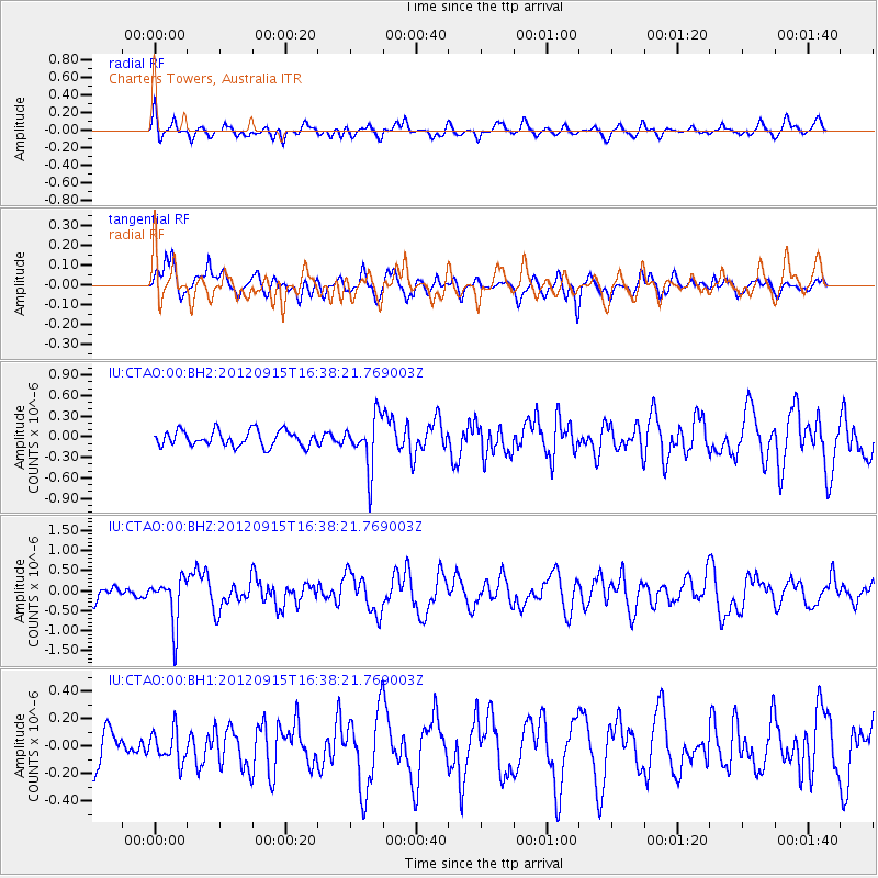
CTAO Charters Towers, Australia - Earthquake Result Viewer
*The percent match for this event was below the threshold and hence no stack was calculated.
| Earthquake location: |
South Of Java, Indonesia |
| Earthquake latitude/longitude: |
-10.7/113.9 |
| Earthquake time(UTC): |
2012/09/15 (259) 16:32:21 GMT |
| Earthquake Depth: |
10 km |
| Earthquake Magnitude: |
5.6 MB, 5.3 MS, 5.7 MW, 5.6 MW |
| Earthquake Catalog/Contributor: |
WHDF/NEIC |
|
| Network: |
IU Global Seismograph Network (GSN - IRIS/USGS) |
| Station: |
CTAO Charters Towers, Australia |
| Lat/Lon: |
20.09 S/146.25 E |
| Elevation: |
357 m |
|
| Distance: |
32.5 deg |
| Az: |
110.546 deg |
| Baz: |
281.745 deg |
| Ray Param: |
$rayparam |
*The percent match for this event was below the threshold and hence was not used in the summary stack. |
|
| Radial Match: |
61.790375 % |
| Radial Bump: |
400 |
| Transverse Match: |
67.377426 % |
| Transverse Bump: |
400 |
| SOD ConfigId: |
558545 |
| Insert Time: |
2013-09-17 18:44:15.850 +0000 |
| GWidth: |
2.5 |
| Max Bumps: |
400 |
| Tol: |
0.001 |
|
Signal To Noise
| Channel | StoN | STA | LTA |
| IU:CTAO:00:BHZ:20120915T16:38:21.769003Z | 2.8613505 | 5.8121805E-7 | 2.0312717E-7 |
| IU:CTAO:00:BH1:20120915T16:38:21.769003Z | 0.888256 | 1.12859375E-7 | 1.2705725E-7 |
| IU:CTAO:00:BH2:20120915T16:38:21.769003Z | 3.280328 | 3.7161894E-7 | 1.1328712E-7 |
| Arrivals |
| Ps | |
| PpPs | |
| PsPs/PpSs | |


