You are here: Home > Network List > IU - Global Seismograph Network (GSN - IRIS/USGS) Stations List
> Station PMG Port Moresby, New Guinea > Earthquake Result Viewer
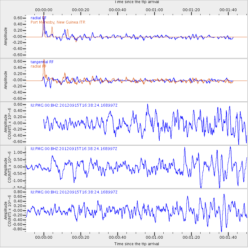
PMG Port Moresby, New Guinea - Earthquake Result Viewer
*The percent match for this event was below the threshold and hence no stack was calculated.
| Earthquake location: |
South Of Java, Indonesia |
| Earthquake latitude/longitude: |
-10.7/113.9 |
| Earthquake time(UTC): |
2012/09/15 (259) 16:32:21 GMT |
| Earthquake Depth: |
10 km |
| Earthquake Magnitude: |
5.6 MB, 5.3 MS, 5.7 MW, 5.6 MW |
| Earthquake Catalog/Contributor: |
WHDF/NEIC |
|
| Network: |
IU Global Seismograph Network (GSN - IRIS/USGS) |
| Station: |
PMG Port Moresby, New Guinea |
| Lat/Lon: |
9.40 S/147.16 E |
| Elevation: |
90 m |
|
| Distance: |
32.8 deg |
| Az: |
90.735 deg |
| Baz: |
264.788 deg |
| Ray Param: |
$rayparam |
*The percent match for this event was below the threshold and hence was not used in the summary stack. |
|
| Radial Match: |
72.030685 % |
| Radial Bump: |
400 |
| Transverse Match: |
70.51478 % |
| Transverse Bump: |
400 |
| SOD ConfigId: |
558545 |
| Insert Time: |
2013-09-17 18:44:55.387 +0000 |
| GWidth: |
2.5 |
| Max Bumps: |
400 |
| Tol: |
0.001 |
|
Signal To Noise
| Channel | StoN | STA | LTA |
| IU:PMG:00:BHZ:20120915T16:38:24.168997Z | 2.554811 | 3.1555808E-7 | 1.2351524E-7 |
| IU:PMG:00:BH1:20120915T16:38:24.168997Z | 0.59763783 | 9.565302E-8 | 1.6005181E-7 |
| IU:PMG:00:BH2:20120915T16:38:24.168997Z | 1.5127163 | 1.5939668E-7 | 1.05371164E-7 |
| Arrivals |
| Ps | |
| PpPs | |
| PsPs/PpSs | |


